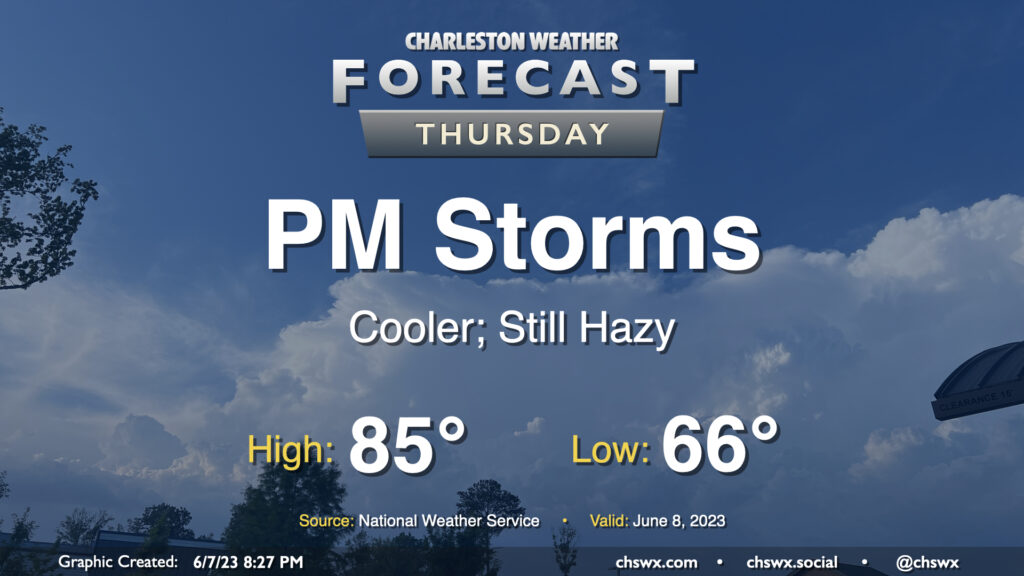
Thursday’s forecast: One more round of afternoon thunderstorms before a break

Our string of stormy afternoons looks to continue on Thursday as a cold front slowly moves through the area. Showers could fire as early as mid-morning, but the better chance of thunderstorms arrives in the afternoon and evening hours as we get some daytime heating in place. Much like the past two days, a few storms could produce gusty winds and hail, so be on the lookout for quickly changing weather conditions and be ready to move indoors quickly if storms approach.
With the front in the area, highs will top out somewhat lower than Wednesday’s 92° — expect generally mid-80s across the region before thunderstorms fire in the afternoon. We could run a little warmer — or cooler — depending on how fast the front gets south of here. (That could also modulate our thunderstorm chances a bit, too.)
Finally, there are no air quality concerns with the ongoing wildfire smoke that is being transported south into the eastern United States from Quebec, though we will continue to see a milky haze in the sky, which should persist into the weekend.
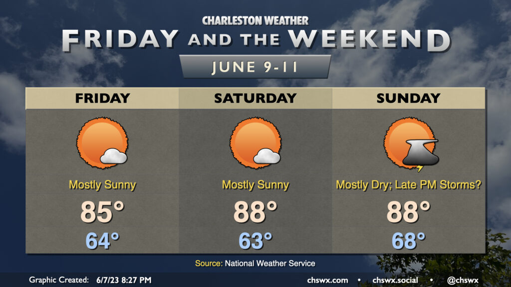
Friday and the weekend: Turning quieter

The front will be well south of us by Friday, ushering in some drier air and making for a rather nice June 9. We’ll start the day in the mid-60s and warm to the mid-80s under almost full sunshine, save for a few clouds and perhaps some lingering wildfire smoke. Temperatures turn a little warmer Saturday as the airmass modifies; expect highs in the upper 80s after starting in the low 60s under mostly sunny skies once again. High pressure then slips offshore for Sunday, turning winds back to the south and pumping in some more humid air ahead of a cold front. Highs top out in the upper 80s once again after a much warmer start in the upper 60s.
Guidance is unanimous in showing some sort of shower and thunderstorm activity with the front, but the timing is very much in question still. Right now, the going forecast is for a mostly dry day with a slight chance of a storm or two late Sunday. If that changes, I’ll let you know!
Follow my Charleston Weather updates on Mastodon, Bluesky, Instagram, Facebook, or directly in a feed reader. Do you like what you see here? Please consider supporting my independent, hype-averse weather journalism and become a supporter on Patreon for a broader look at all things #chswx!