Rest of the work week: A brief dip in humidity, then warming back up

After another very warm day Tuesday, a cold front will get through the area overnight and into early Wednesday, bringing an all-too-brief round of much drier air to the area. (A few showers are possible too.) We start the day in the mid-70s, but as the somewhat cooler and drier air moves in, we’ll find highs will top out generally in the upper 80s. Lower dewpoints, though, are what will make upper 80s to around 90° much more tolerable. We should see dewpoints mix down to the low 60s for the first time since June. Heat index won’t be a factor, and it should overall be a comparatively nice afternoon to do some things outside for a change.
Source: Iowa Environmental Mesonet Autoplotter
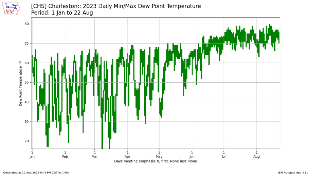
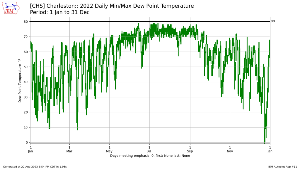
The above chart plots dewpoints recorded at the airport so far in 2023, and suffice to say, last two months have been firmly in the “air you can wear” category. (Not that you needed a plot to tell you that.) The good news is that once we start getting into September, we should start to see some of the extreme dewpoints of July and August finally begin to moderate a little bit, as seen in the 2022 graph below.
Source: Iowa Environmental Mesonet Autoplotter
Bottom line: Hang in there folks, as the trend will slowly be getting better.
That’s not to say, though, that there won’t be more warm and muggy days ahead, and indeed, we’ll begin to see dewpoints begin to moderate back into the mid-60s on Thursday and upper 60s to around 70° on Friday. Air temperatures will also once again head north of 90° given plenty of sunshine. Heat indices on Thursday will run just a couple degrees warmer than the air temperature, while on Friday air temperatures in the mid-90s combined with dewpoints near 70° will yield heat indices back over 100°. So, enjoy the drier air on Wednesday while you’ve got it!
The rest of the work week should remain rain-free as the ridge of high pressure aloft continues to dominate the weather pattern, with no substantial rain chances expected until Sunday as another front drops into the area.
Follow my Charleston Weather updates on Mastodon, Bluesky, Instagram, Facebook, or directly in a feed reader. Do you like what you see here? Please consider supporting my independent, hype-averse weather journalism and become a supporter on Patreon for a broader look at all things #chswx!