The week ahead: High pressure in control; warm and sunny days to ensue
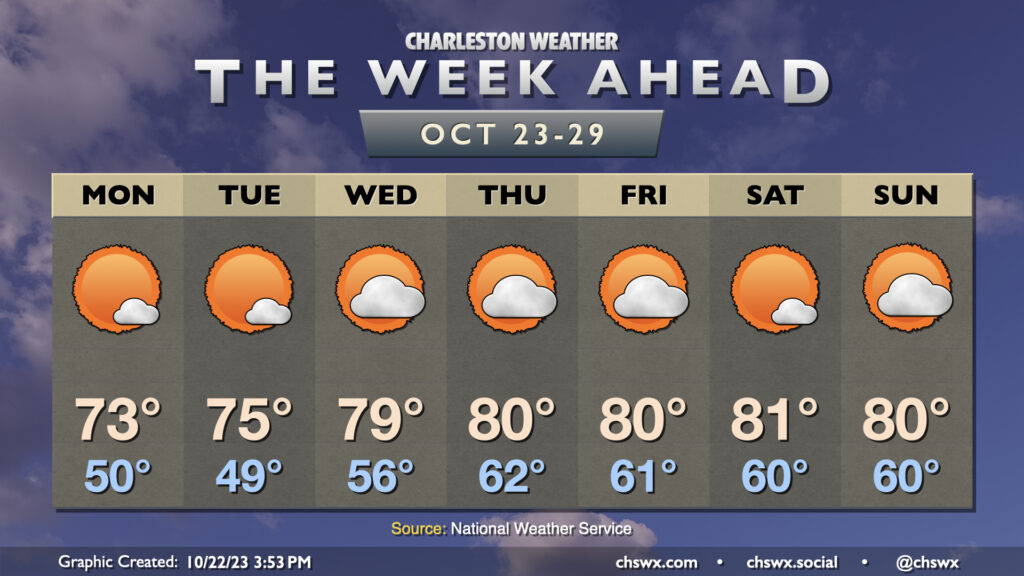
The story of this week’s weather will be high pressure keeping a firm grasp on the area for the rest of the week (and maybe even the rest of October). This will lead to generally quiet weather, with a warming trend bringing us into the low 80s starting around midweek. Monday will be the coolest of the set in the wake of a dry cold frontal passage; we start the day around 50° and warm into the low 70s in the afternoon with just a few clouds. Tuesday starts a touch cooler, but the warming trend will begin with temperatures reaching a little warmer in the afternoon. A decent stretch of above-normal warmth takes hold from there, with variable cloud cover but little else to write home about as moisture is generally scant. All in all, it’s not a bad week to get the car washed (note to self) and enjoy some outdoor lunches.
The only concern may end up being coastal flooding at times of high tide possibly starting as early as Tuesday. Winds will be out of the northeast as high pressure settles in to our northwest, and this combined with the upcoming full moon will once again start to send water levels above coastal flood criteria as we head into the latter half of the week. Keep an ear out for Coastal Flood Advisories from the National Weather Service.
Tropics: Tammy departs the Leeward Islands as a hurricane
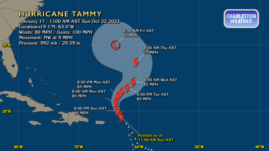
Hurricane Tammy is departing the Leeward Islands as expected, moving NW at 9 MPH with 80 MPH winds and gusts approaching 100 MPH. Tammy will turn north and then northeast on Monday, but by Wednesday it may start bending back a little more westward as steering breaks down and a trough interacts with Tammy. By Friday, it could be heading back west toward Bermuda, but shear and the aforementioned trough should help Tammy lose its tropical characteristics. Guidance is mixed on Tammy’s fate beyond Friday, with some models continuing a westward trend while others show it turning back eastward (the more likely scenario, IMO). Right now, though, Tammy continues to pose no risk to us here at home.
Elsewhere in the tropics, an area off the coast of Nicaragua has a 60% chance to develop into a tropical cyclone over the next few days, but it should be short-lived as it’s expected to head ashore shortly after development. It won’t be a factor for us in the Lowcountry.
Follow my Charleston Weather updates on Mastodon, Bluesky, Instagram, Facebook, or directly in a feed reader. Do you like what you see here? Please consider supporting my independent, hype-averse weather journalism and become a supporter on Patreon for a broader look at all things #chswx!