Tuesday: Chilly start, but a warming trend begins
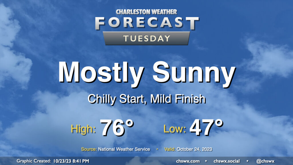
We get off to a fairly chilly start on Tuesday as lows bottom out in the upper 40s thanks to clear skies and light winds. This will be the low-water mark (so to speak) for temperatures, though, as we head into the rest of the week. Highs on Tuesday top out in the mid-70s once again, perhaps a degree or two warmer than we saw on Monday. All in all, another nice October day.
Rest of the work week: 80s return along with some minor coastal flooding
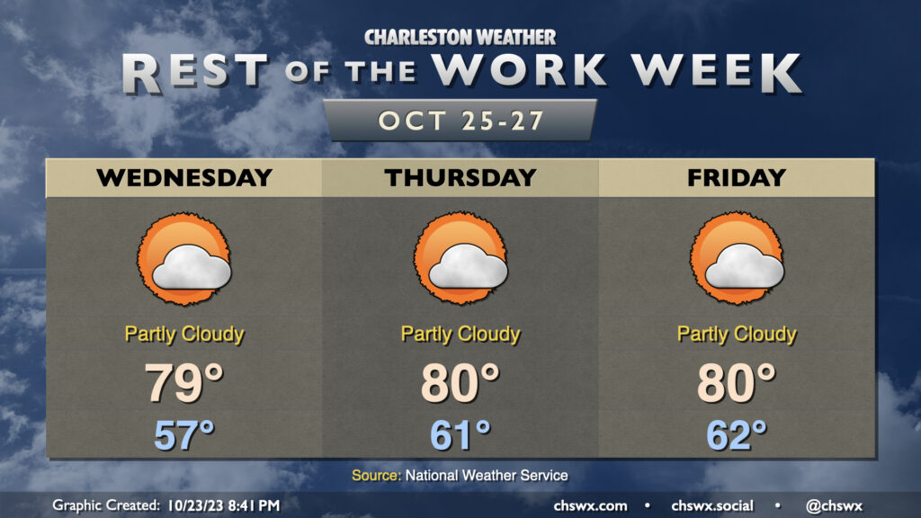
A warming trend commences as deep-layer high pressure remains in control. Wednesday starts significantly warmer than Tuesday, with temperatures running about 10° warmer in the morning. Highs top out near 80° Wednesday, and should reach or even get a little warmer than 80° for Thursday and Friday. Lows will run several degrees above normal as well, with mild-for-late-October starts in the low 60s. These temperatures continue into the weekend, too.
Northeasterly winds and the upcoming full moon could contribute to some minor coastal flooding issues around times of high tide beginning Wednesday. Right now, it doesn’t look like it’ll get too far out of hand, but we’ll need to be ready for some salt water on some roads at times. Stay alert for possible Coastal Flood Advisories from the National Weather Service.
Tropics: Tammy continues northward, TD Twenty-One develops
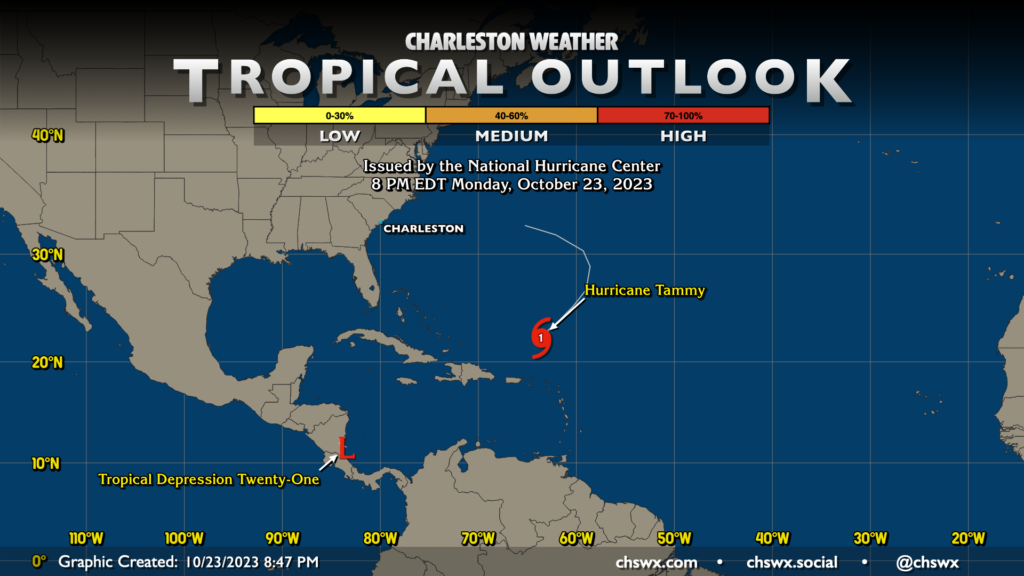
We’ve now got two active tropical cyclones in the Atlantic: Hurricane Tammy, which is turning more northeastward as a Category 1 hurricane, and Tropical Depression Twenty-One, which should be short-lived as it makes landfall on Nicaragua by tomorrow.
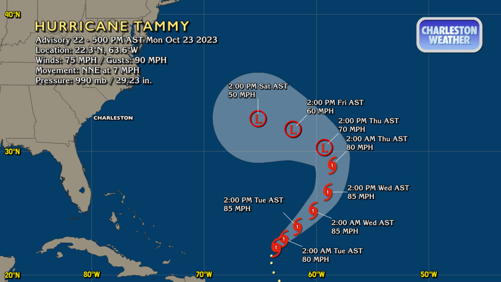
Tammy is an interesting case. It should remain a Category 1 hurricane for a couple more days as it heads northeast. Shear will increase over the storm, and a trough will eventually interact with it to force extratropical transition by Thursday. The official track has Tammy turning westward as a post-tropical cyclone, gradually winding down, but perhaps giving Bermuda a little lashing over the weekend. From there, it’s a tough call to see exactly where it will go — ensemble members are split between a sharp turn back east and out to sea, while others try to bring Tammy toward the coast later next week. For now, it’s entirely too soon to know exactly what Tammy will do, and it’s not something to get overly worked up over. We’ll keep an eye on it to see what it does.
Follow my Charleston Weather updates on Mastodon, Bluesky, Instagram, Facebook, or directly in a feed reader. Do you like what you see here? Please consider supporting my independent, hype-averse weather journalism and become a supporter on Patreon for a broader look at all things #chswx!