Thursday: Still warm and partly cloudy
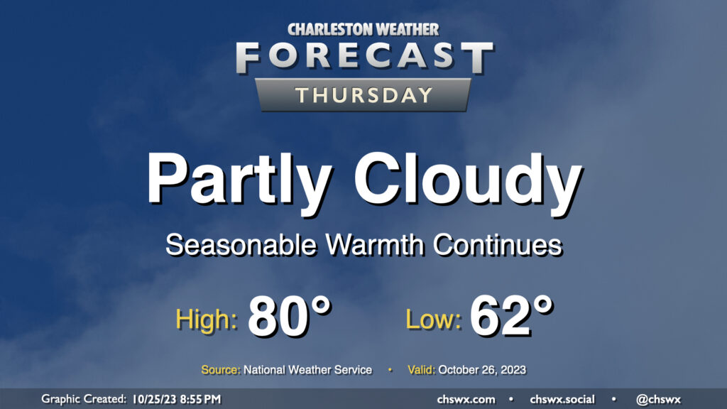
Rinse and repeat: More quiet and warm weather is on tap for Thursday (and beyond!) High pressure remains in control, and that’ll keep things rain-free and rather warm for late October. We start the day in the low 60s (for reference, the normal low for October 26 is 54°) and warm to around 80° in the afternoon. Much like Wednesday, we’ll see a few clouds amongst otherwise blue skies.
The only fly in the ointment will be the potential for some minor coastal flooding with the Thursday evening high tide. Water levels should peak between 7-7.2′ in the harbor, and this’ll cause some salt water to spill onto the typical trouble spots roughly an hour or two on either side of the 6:49 PM high tide. We’ll probably land a Coastal Flood Advisory during Thursday evening’s commute, so be ready to route around a little salt water especially around the Citadel and MUSC.
Friday & the weekend: Turning even warmer
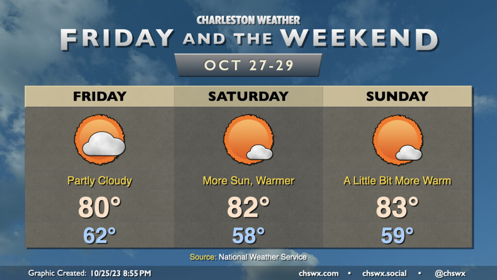
The warm weather turns even a little warmer as we head into the weekend as ridging aloft holds firm for a few more days. Temperatures on Friday top out around 80°, while we’ll head a little further into the low 80s for Saturday and Sunday with a little bit more in the way of sunshine to boot. Dewpoints in the low 60s should stay on the slightly humid side of comfortable, and winds will generally be light out of the west and southwest.
We’ll keep the warmth going into Monday, though changes will arrive for Halloween and beyond as the pattern aloft changes and a cold front drives through the area. We might even need a Sweater Weather Watch for November 1 as the opening bid from NWS only has highs in the low 60s! Stay tuned…
Tropics: Tammy reaches Cat 2, but is no concern for us
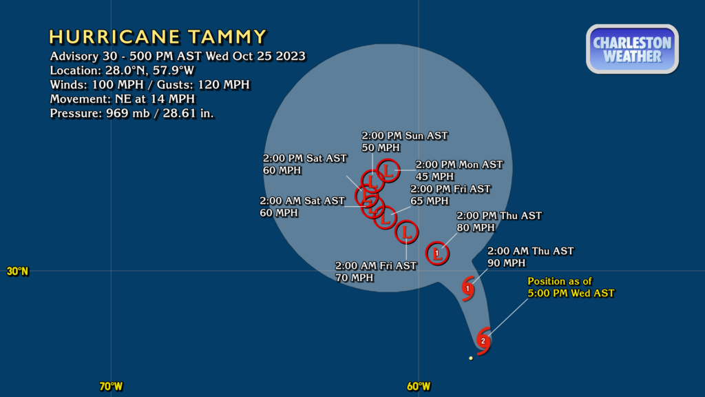
Hurricane Tammy reached Category 2 strength today, likely peaking with maximum sustained winds around 100 MPH before starting to weaken overnight into Thursday. By Thursday afternoon, in fact, Tammy should be largely devoid of its tropical characteristics, making extratropical transition into a still quite-powerful cold-core cyclone. From there, Tammy will drift northwestward and then meander east of Bermuda over the weekend. It represents no threat to us here at home.
Elsewhere, the tropical Atlantic is quiet; NHC does not expect new tropical development in the next seven days.
Follow my Charleston Weather updates on Mastodon, Bluesky, Instagram, Facebook, or directly in a feed reader. Do you like what you see here? Please consider supporting my independent, hype-averse weather journalism and become a supporter on Patreon for a broader look at all things #chswx!