Tuesday: Turning cooler
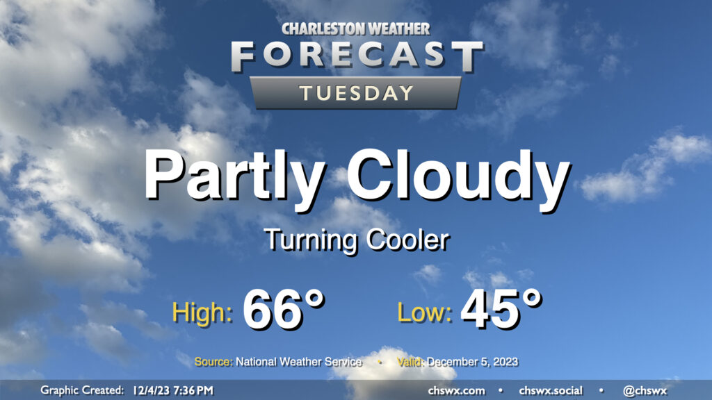
A reinforcing shot of cool air arrives overnight, and by Tuesday morning, we’ll wake up to temperatures about 10-15° cooler than we woke up to on Monday. Expect to start the day in the mid-40s before warming to the mid-60s in the afternoon under partly cloudy to mostly sunny skies. These temperatures are right around normal for December 5.
Rest of the work week: Even cooler Wednesday and Thursday; warming begins Friday
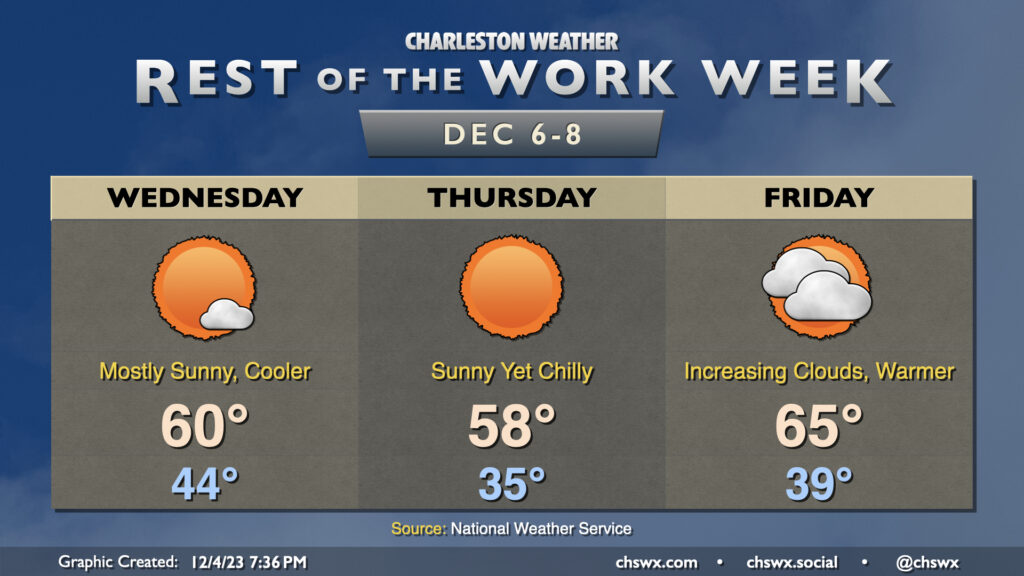
Yet another dry cold front moves by on Wednesday, and this will help kick up the winds a little bit as strong high pressure builds in from the west. Temperatures will start in the mid-40s once again, but cooler and even drier air moving in behind the front will limit Wednesday’s high to around 60°. This is a few degrees on the cool side of normal for early December. Thursday will be the coolest start to the week, with lows bottoming out in the mid-30s in the metro with thermometers possibly going below freezing further inland. We’ll warm just to the upper 50s in the afternoon despite unfettered sunshine. The cool spell doesn’t last long: after an upper 30s start Friday, temperatures warm to the mid-60s as high pressure slips offshore and warmer air starts to move back in. We’ll see an uptick in cloud cover as well.
A storm system should affect the area mainly later this weekend. We should get Saturday in mostly rain-free, with scattered showers possible Sunday ahead of a cold front. Timing and details are still tough to pin down this far out, so stay tuned for forecast updates.
Follow my Charleston Weather updates on Mastodon, Bluesky, Instagram, Facebook, or directly in a feed reader. Do you like what you see here? Please consider supporting my independent, hype-averse weather journalism and become a supporter on Patreon for a broader look at all things #chswx!