Friday: Turning breezy with showers and storms in the afternoon and evening; cooling off for the weekend
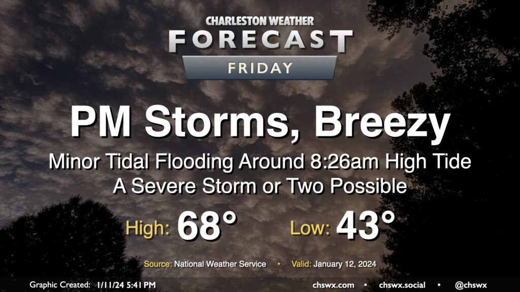
Another storm system will impact the area on Friday with gusty winds and some showers and storms in the afternoon and evening hours, with a few pockets of severe weather possible, but certainly not the widespread threat that we saw on Tuesday.
We’ll start the day on the chilly side — expect lows in the low 40s once again. We’ll warm rapidly and turn much more humid by mid-morning, though, as a warm front lifts north of the area. Temperatures should be well into the 60s by noon and should top out in the upper 60s in the afternoon. As the warm front lifts north, winds will switch southeastward to southerly and increase, reaching sustained speeds of 20-25 MPH in the afternoon and evening with gusts 30-40 MPH possible outside of thunderstorms. This will make bridge travel tricky, but not impossible, either.
We should get off to a generally rain-free start in the morning, but as the warm front lifts north, scattered showers and a few thunderstorms will develop and move through. The best risk for any severe weather appears to arrive later in the afternoon and early evening, when shear and instability appear maximized ahead of the incoming cold front. However, it’s an open question just how unstable we get given the expected showers in the area. There may be enough for a few stronger storms to develop with damaging wind gusts the primary hazard. If we destabilize a little more than expected, though, the strong shear particularly near the surface could make conditions favorable for a tornado or two in addition to a more widespread damaging wind threat.
Finally, we will start the day with some minor coastal flooding as water levels are expected to peak around 7′ in the harbor near the 8:26am high tide. However, we should be rain-free around that tide, so widespread issues aren’t anticipated.
Bottom line on Friday is this: A few storms could turn strong to severe, and you’ll want to pay attention to possible watches and warnings once again. It’ll be breezy, too, and there’s the risk that a few folks may have some power blips. But it’s nowhere near the ballpark of what we experienced on Tuesday.
Weekend forecast: Turning cool and quiet
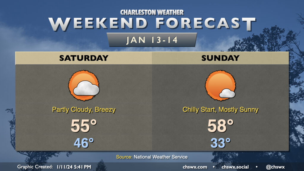
The storm system’s cold front will swing through early Saturday morning, and will usher in another round of cooler and drier air. It’ll remain breezy behind the front, and temperatures in the mid-40s to start the day will struggle to the mid-50s in the afternoon as cold air continues to blow into the area. Expect generally partly cloudy skies.
Sunday will get off to a chillier start — we may be touching freezing in some spots — but will get a touch warmer than we saw on Saturday, with highs heading to the upper 50s under mostly sunny skies and with lighter winds than we expect on Saturday. Our next rain chance arrives Monday evening and lasts through Tuesday, ushering in much cooler-than-normal temperatures for the rest of next week.
Follow my Charleston Weather updates on Mastodon, Bluesky, Instagram, Facebook, or directly in a feed reader. Do you like what you see here? Please consider supporting my independent, hype-averse weather journalism and become a supporter on Patreon for a broader look at all things #chswx!