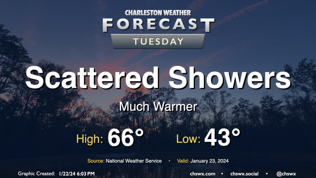
Tuesday: Warming trend continues, maybe a few showers

After a day in which we warmed up some 14° compared to Sunday with a high of 60° at the airport, the warming trend continues for Tuesday and beyond as surface high pressure continues to move offshore. Temperatures on Tuesday start in the low-to-mid-40s — roughly where we were for a high on Sunday — and warm into the mid-60s in the afternoon under mostly cloudy skies. A few showers will be possible at times, but any rain will be generally light. Still, y’all know how traffic can get even with the lightest of rain, so prepare accordingly.
Rest of the work week: Turning even warmer with unsettled conditions persisting

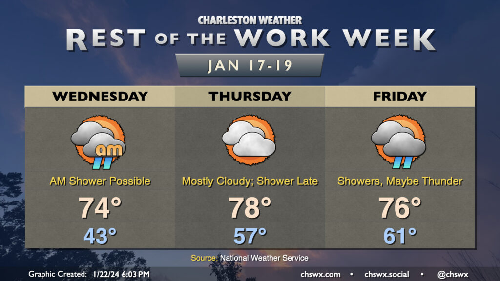
Spring-like warmth awaits as we get to the mid-to-latter part of the work week. A warm front lifts north Wednesday morning, sending highs to the mid-70s in the afternoon with a shower or two possible primarily in the morning. Cloud cover will persist but we may get much of Wednesday in rain-free. It’s a similar situation on Thursday, where cloud cover will hang around, but temperatures will run even warmer — expect lows in the mid-50s followed by highs in the upper 70s. If some more sun peeks out, a run at 80° might not be out of the question. (The record high of 82° set in 1949 appears safe, though.)
As a front draws closer to the area, a shower or two will be possible later Thursday, primarily around and after sunset. Shower chances improve for Friday ahead of a front, with a thunderstorm not totally out of the question. Temperatures will be the main story, though, with lows in the low 60s yielding to highs in the mid-70s once again despite the potential for shower activity. We may see a little more in the way of rainfall totals on Friday, but it still shouldn’t get too out of hand.
Unsettled weather continues into the weekend before a more proper cold front swings through Sunday, chilling temperatures back to January normals for next Monday.
Follow my Charleston Weather updates on Mastodon, Bluesky, Instagram, Facebook, or directly in a feed reader. Do you like what you see here? Please consider supporting my independent, hype-averse weather journalism and become a supporter on Patreon for a broader look at all things #chswx!