Rest of the work week: Winds diminishing, turning warmer
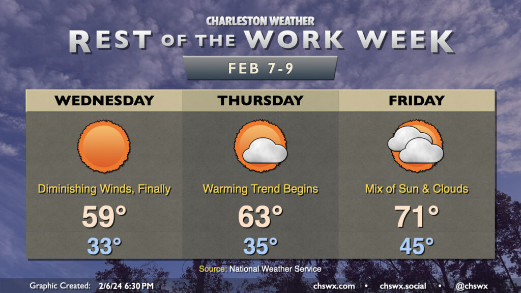
We’re just about done with the chillier weather for a few days, but first, Wednesday awaits. Lows on Wednesday should flirt with freezing, and continued breezy northerly winds will help it feel like the mid-20s. You’ll want to dress in layers to start, though you should be able to shed a layer or two later in the day as temperatures approach 60° and winds, mercifully, continue to die down.
There is a risk for some minor coastal flooding with the 5:33am high tide, though I wouldn’t be surprised to see the forecast of 7.3-7.5′ revised downward given the past two mornings have come in lower than expected. (Watch this be the one time the tide does exactly what the evening blog post says it will.) In any event, any flooding issues should be resolved before the bulk of the commute, but if you are an early commuter and downtown is in your plans, keep an eye out for possible flooded or closed roads.
The warming trend begins Thursday. We start the day in the mid-30s, but as high pressure shifts overhead and offshore, winds will be calm and temperatures will head into the low-to-mid-60s in the afternoon with a few clouds. Cloud cover will increase as more moisture gets transported into the area Thursday evening into Friday, but that won’t stop Friday’s temperatures from breaching 70° — quite the role reversal from how we started the week. We stay rain-free Friday into much of Saturday, but as a front approaches from the west, expect showers to return to the forecast as early as Saturday night into Sunday.
Follow my Charleston Weather updates on Mastodon, Bluesky, Instagram, Facebook, or directly in a feed reader. Do you like what you see here? Please consider supporting my independent, hype-averse weather journalism and become a supporter on Patreon for a broader look at all things #chswx!