Thursday: Another chilly start, but a subtly warmer afternoon
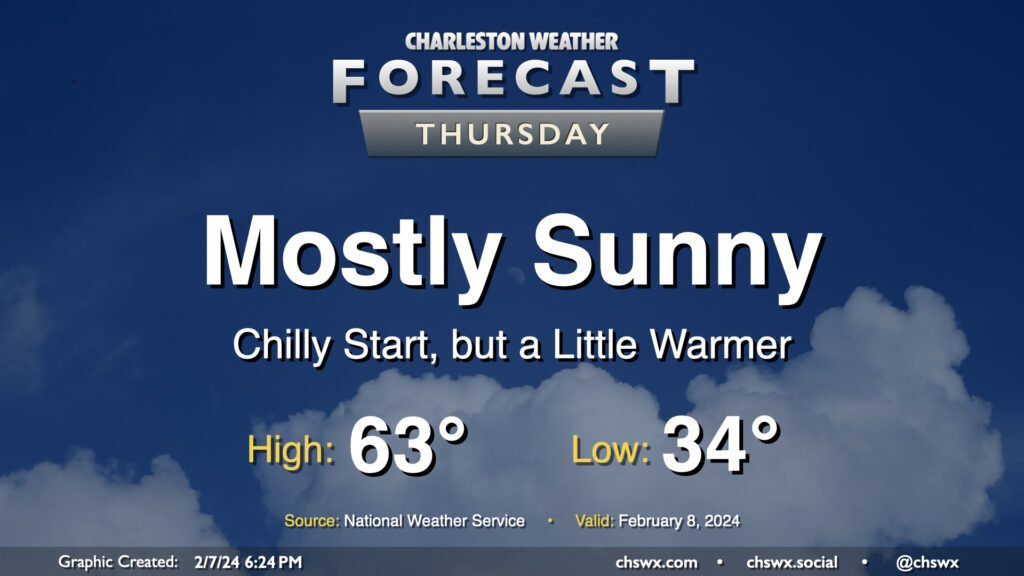
We have another chilly start ahead on Thursday as lows drop to the low-to-mid-30s across much of the metro one more time as high pressure moves overhead. We’ll see mostly sunny skies for a fair bit of Thursday before high pressure begins to slip further offshore and cloud cover starts to increase later in the day. Temperatures will show signs of a subtle warming trend as we top out in the low to mid-60s Thursday afternoon, a few degrees warmer than we have been the past couple days. Overall, it’ll end up being a fairly climatologically typical February day after the cooler-than-normal start.
Friday & the weekend: Return of the 70s
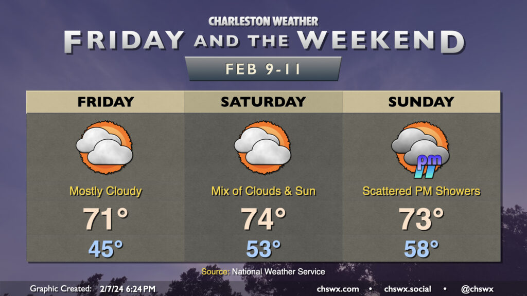
As high pressure slips offshore, winds go around to the south, and this will start drawing much warmer air into the area. We start Friday in the mid-40s before warming to the low 70s in the afternoon despite mostly cloudy skies. We’ll run even warmer on Saturday: expect lows in the low 50s to yield to highs in the mid-70s in the afternoon as the sun peeks through cloud cover from time to time. Rain holds off through Sunday morning before showers begin to return to the forecast in the evening as a front gets closer to the area. The bulk of the rain associated with this storm system falls Monday, and by Tuesday rain will depart and temperatures will be back toward mid-February normals.
Photographers, take note as well…temperatures in the 70s moving across the cooler waters could create some cool sea fog scenes this weekend. Take advantage if you can!
Follow my Charleston Weather updates on Mastodon, Bluesky, Instagram, Facebook, or directly in a feed reader. Do you like what you see here? Please consider supporting my independent, hype-averse weather journalism and become a supporter on Patreon for a broader look at all things #chswx!