A couple of rounds of storms on Tuesday before a warm close to the week
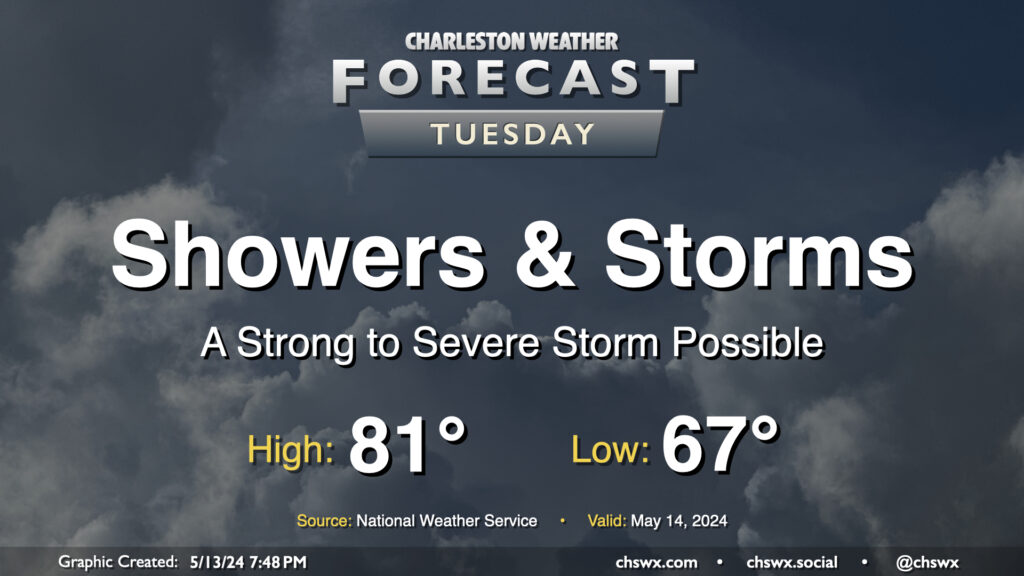
Tuesday figures to be a fairly active weather day with a couple rounds of storms expected. The first one will be ongoing as we wake up and commute; periods of heavy rain will be possible within thunderstorms, so be ready for delays in the morning. One other twist will be in the form of a warm front that will lift north across the area as we get into mid-morning; this could enhance low-level shear enough where the environment might support a brief tornado (though this risk is fairly low all things considered). The first round of showers and thunderstorms should get offshore roughly around midday, and many of us will catch a break from the rain early Tuesday afternoon. Heading into mid-to-late afternoon, expect additional scattered showers and thunderstorms to fire across the area. There will be a damaging wind risk within the strongest storms, so you’ll want to keep an ear out for possible weather warnings. Storms will be possible well into the evening before chances head back down around midnight or so.
Temperatures Tuesday start on the warm and muggy side in the mid-to-upper 60s. Expect highs to top out in the low 80s given the expected showers, thunderstorms, and overall cloud cover.
Rest of the work week: Warming up, then more storms
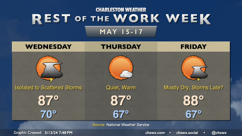
Temperatures warm well above normal for Hump Day and the rest of the work week. While a thunderstorm or two will be possible Wednesday, many of us won’t see any rain, and so temperatures will be able to head into the mid-to-upper 80s. High pressure squelches the thunderstorm risk on Thursday, so expect another warm day with highs once again reaching into the upper 80s under partly cloudy to mostly sunny skies. Friday will be mostly dry as well, though the next storm system will draw closer throughout the day, and there’s a chance we could see a few storms later in the day. High temperatures remain above normal in the upper 80s.
We’ll keep these above-normal temperatures going into the weekend with a few storms expected Saturday and maybe Sunday, but stay tuned for fine-tuning of the details there.
Follow my Charleston Weather updates on Mastodon, Bluesky, Instagram, Facebook, or directly in a feed reader. Do you like what you see here? Please consider supporting my independent, hype-averse weather journalism and become a supporter on Patreon for a broader look at all things #chswx!