Tuesday: Humidity returns, a few PM storms
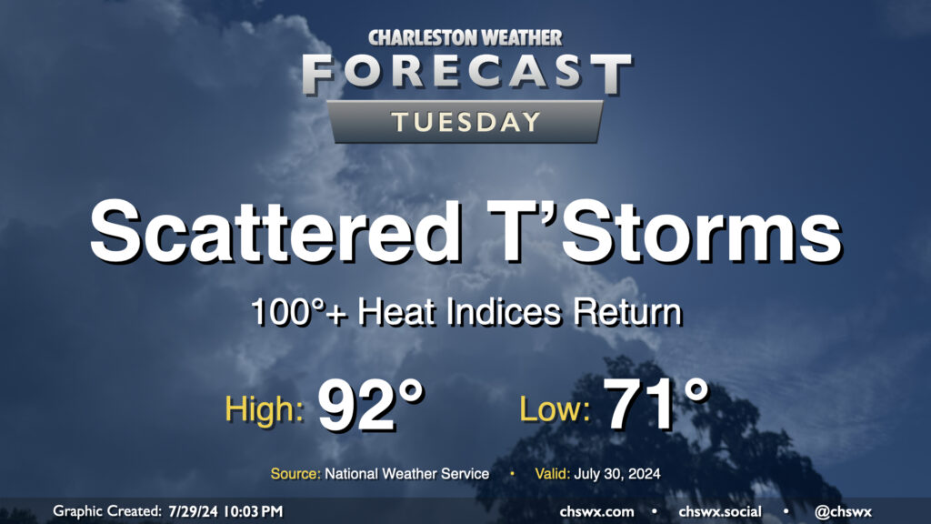
Well, the respite is decidedly over: we’re back to 100°+ heat indices on Tuesday as surface high pressure shifts offshore and higher-dewpoint air returns to the area. We start the day in the low 70s one more time, but will warm quickly into the 80s by mid-morning and should be back in the 90s by early afternoon. Dewpoints look to climb into the mid-70s throughout the day, and this will yield heat indices around 103° — hot to be sure, but shy of advisory criteria. Scattered showers and thunderstorms are primarily expected in the afternoon and evening hours, though a few showers can’t be ruled out in the morning. A few showers may try to get going on the seabreeze, but high-resolution guidance suggests that the bulk of any activity will get going perhaps in the Midlands and Upstate before dropping southeasterly into the metro. Some heavy rain is possible, and a damaging wind gust or two is not out of the question, either. Keep an ear out for possible warnings Tuesday evening, just in case.
Rest of the work week: Advisory-level heat returns
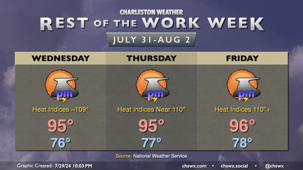
A ridge of high pressure will be building in aloft beginning Wednesday, and this will help drive down thunderstorm coverage and drive up the heat across the area. Air temperatures topping out in the mid-90s combined with dewpoints in the mid-to-upper 70s will yield increasingly dangerous heat indices as the week progresses. Expect a string of Heat Advisories, with some flirtation with an Excessive Heat Warning on Friday as heat indices exceed 110°. And while some storms may yet fire on the seabreeze as it moves inland each day, the upper ridge will keep that risk tamped down, so don’t bank on any relief from storms.
We’re going to keep this heat going into the weekend, though rain chances start to tick up in the latter half getting into early next week, which will help put a governor on some of the higher air temperatures.
Tropics: Probabilities ticking up for something developing in the Atlantic later this week
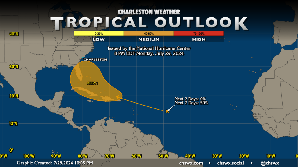
The National Hurricane Center continues to watch a fairly dry tropical wave as it meanders across 50°W toward the Lesser Antilles. As the wave shakes loose from the dry air and Saharan dust that’s keeping it largely convection-free, it could begin some slow development as it moves north of Puerto Rico and Hispaniola. It remains far too early to tell what, if anything, will come of this wave, but it’ll be worth watching over the next few days given its latitude and overall heading. Check in with forecast updates periodically, but especially as we head into the second half of the week for more information on this system.
Follow my Charleston Weather updates on Mastodon, Bluesky, Instagram, Facebook, or directly in a feed reader. Do you like what you see here? Please consider supporting my independent, hype-averse weather journalism and become a supporter on Patreon for a broader look at all things #chswx!