Thursday: Heat’s turning up, a few afternoon storms
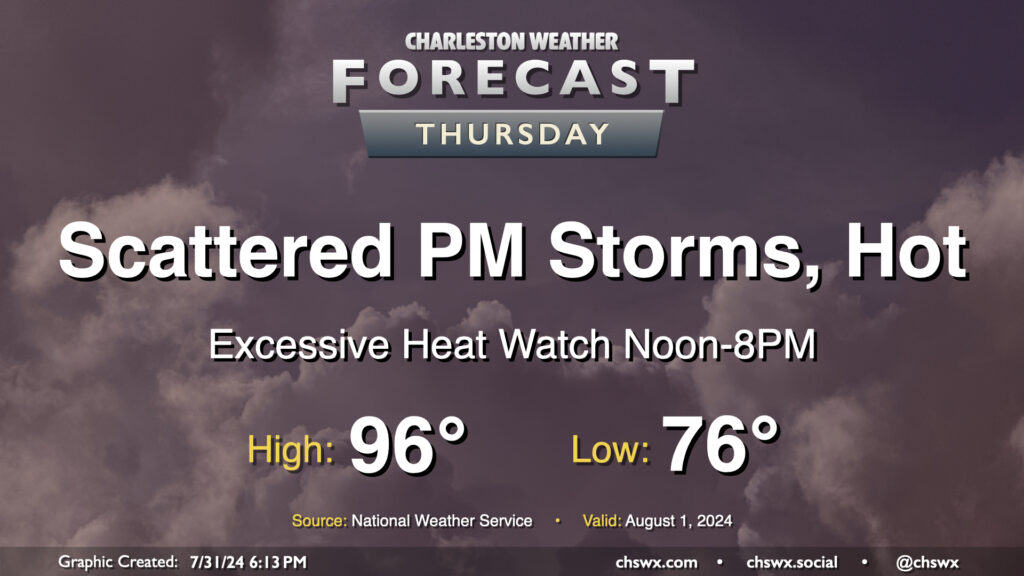
Heat will be the main weather story on Thursday as air temperatures reach into the mid-90s and dewpoints peak in the mid-70s, combining for heat indices that could approach 110-115° in the afternoon. This has prompted an Excessive Heat Watch from noon-8PM, when heat indices could be highest. If the forecast indicates heat indices approaching or exceeding 113°, this could be upgraded to an Excessive Heat Warning; otherwise, a Heat Advisory would likely be the move barring an unexpected cooler start (like we saw today, in fact!)
Showers and thunderstorms will be possible in the afternoon and evening hours as the seabreeze pushes inland. We could also see storms coming our way from the Midlands once again as well. Widespread severe weather is not expected, but you can never rule out a damaging wind gust or two this time of year.
Friday & the weekend: Staying hot, scattered storms continue
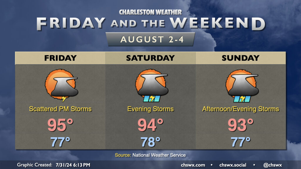
Expect more heat advisories for Friday and the upcoming weekend along with scattered afternoon and evening thunderstorms each day. Temperatures will start well into the mid-to-upper 70s each morning, with lows in the 80s a pretty good bet along the coast and in downtown Charleston. Temperatures then rise to the mid-90s on Friday and Saturday with slightly cooler air temperatures on Sunday, but the dewpoints should keep us in Heat Advisory territory with heat indices approaching 108° a likelihood each afternoon. And as always, scattered storms could produce sporadic strong wind gusts as they do in the summertime.
Tropics: Tropical wave continues moving westward, future clear as mud
The tropical wave we’ve been watching for the past few days has started to develop some convection, but is no better organized otherwise as it continues to fight off some dry air. Models continue to disagree quite a bit with its future evolution, too — in fact, more so today than in previous days, including some infighting between the European ensemble members — and so it remains up in the air on just what, if anything, will develop and how strong it will be. The National Hurricane Center maintains a 60% probability that this will develop in the next seven days, but the swath where it could develop has now shifted further west into the Gulf of Mexico. Still something to watch for early next week, but uncertainty remains quite high at this point. Stay tuned, but it’s still nothing that’s bothering me too much right now.
Follow my Charleston Weather updates on Mastodon, Bluesky, Instagram, Facebook, or directly in a feed reader. Do you like what you see here? Please consider supporting my independent, hype-averse weather journalism and become a supporter on Patreon for a broader look at all things #chswx!