Thursday: Stretch of nice weather begins in earnest
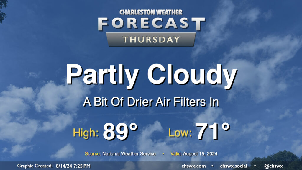
High pressure wedging southward across the area has brought some cooler and drier air to the area this evening, with dewpoints falling into the mid-60s (it’s been a minute!). This will yield a fairly nice (but still warm) day on Thursday. We’ll start the day in the low 70s and warm to the upper 80s in the afternoon under partly cloudy to mostly sunny skies. With the lack of moisture and influence of high pressure, rain isn’t expected (and won’t be for a few days). Overall, not too shabby for mid-August!
Friday & the weekend: A couple more days of drier air, then moisture returns
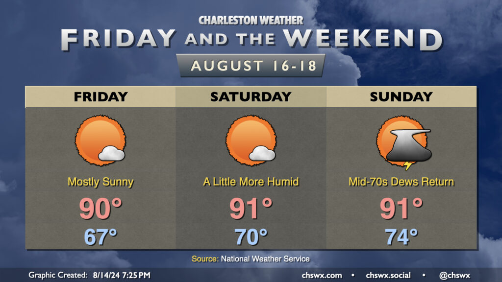
Quiet weather continues for Friday and Saturday as drier air and high pressure continue to put the kibosh on much, if any, convection. Temperatures will remain generally around mid-August norms, topping out right around 90° each afternoon. Rain-free conditions should continue Friday and Saturday before high pressure starts to lose its grip on the area beginning Sunday. After one more day of dewpoints in the 60s on Friday, we’ll see those begin to slowly rise back through the 70s starting Saturday as moisture return increases. By Sunday, we should be dealing with scattered afternoon thunderstorms once again, and we’ll keep that general pattern in place for much of next week.
Coastal flooding concerns possible this weekend
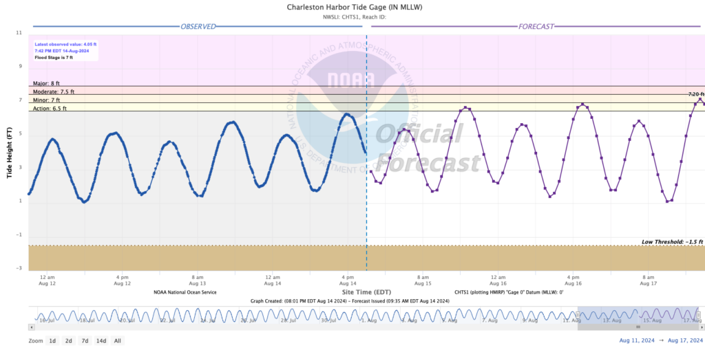
Northeasterly winds could drive water levels higher in the harbor this weekend, and we will need to watch the evening high tides beginning Friday for the potential for coastal flooding as a result. The total water level forecast from the National Weather Service brings the tide very close to flood stage around 6PM Friday, while minor flooding is forecast for Saturday around 7PM. Keep an ear out for possible Coastal Flood Advisories from the National Weather Service.
River flooding update
Rivers across the area are generally falling, though we will be dealing with this part of Debby’s aftermath for several more days.
Edisto River near Givhans Ferry
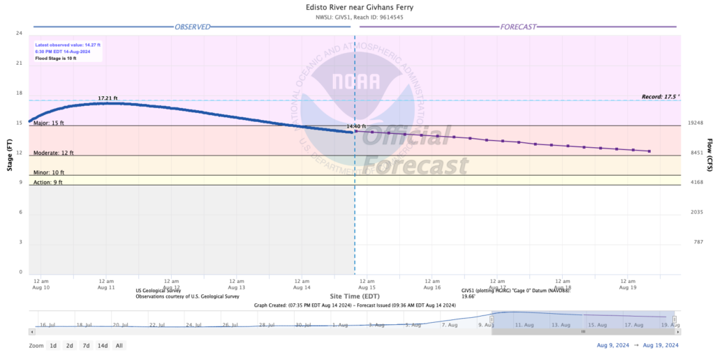
The Edisto River near Givhans Ferry has fallen below major flood stage and is forecast to continue to fall into next week given the rain-free conditions that are expected. However, moderate flooding looks to persist through the weekend, which will keep flooding issues in play for roads and properties in the Edisto basin. A River Flood Warning remains in effect for this area until further notice.
Ashley River at Cooke Crossroads
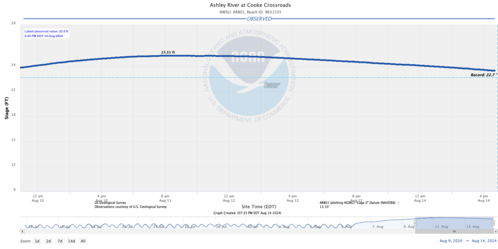
The Ashley River has continued to slowly fall over the last few days, though as of this writing it still remains above the record level of 22.7′ that was set during the October 2015 flood event. A Flood Advisory continues for portions of Summerville around the Ashley, including the Ashborough neighborhood, through 9:45am Thursday. I anticipate that it will remain in effect for at least one more day, but we’ll see how conditions on the ground are come tomorrow morning.
Santee River near Jamestown
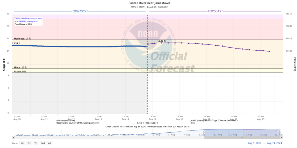
The Santee River near Jamestown is actually underperforming the forecast a little bit — not a bad thing when we’re talking about river flooding. The current forecast is for a crest around 16.2′ early Thursday morning, but we’ll see what the Southeast River Forecast Center has in mind given the current observations. Still, minor flooding remains in the forecast through the weekend here as well, and a River Flood Warning remains in effect until further notice as a result.
Tropics: Ernesto becomes a hurricane
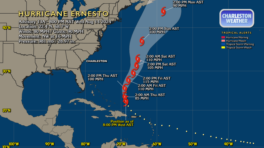
Ernesto became a hurricane earlier today, and is continuing to strengthen according to Hurricane Hunter recon. At 8PM, Ernesto was located north of Hispaniola, moving NW at 16 MPH. It is making the expected turn to the north as a result of the trough that is bringing us this slightly drier airmass nudging it that way; a due-north to northeast motion is likely to begin Thursday. It remains a concern for Bermuda as a high-end Category 2 or low-end Category 3 hurricane; a Hurricane Watch is out for the island as a result. Ernesto remains no threat to the Lowcountry, though rough surf and an accompanying higher risk for rip currents will be an issue at the beaches this weekend as swell from Ernesto makes it to our shores.
Elsewhere in the tropics, NHC is not expecting new formation within the next week. We’ll keep you posted in case that changes.
Follow my Charleston Weather updates on Mastodon, Bluesky, Instagram, Facebook, or directly in a feed reader. Do you like what you see here? Please consider supporting my independent, hype-averse weather journalism and become a supporter on Patreon for a broader look at all things #chswx!