Friday & Labor Day Weekend: Seasonably warm, mostly sunny before a front on Monday
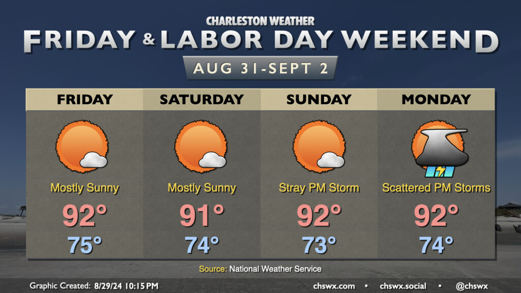
The good news is that much of the upcoming Labor Day weekend is looking pretty good: expect highs generally to run in the low 90s each afternoon, with heat indices in the upper 90s expected after taking into account dewpoints in the low to mid-70s. A stray shower or storm can’t be completely ruled out, especially as you head inland, but otherwise we should stay mostly quiet across the area.
A pattern change is in the offing, though, that will help drive a front toward the area for Monday. We’ll start Labor Day in the mid-70s once again, warming to the low 90s in the afternoon. As the front pushes southward, the risk for showers and thunderstorms will increase, with a decent shot at some storms arriving by Monday evening. This will kick off a stretch of unsettled — but cooler — weather as the front stalls to our south and high pressure wedges southward across the area. A nearby coastal trough should keep rain chances in place for much of next week, though we have a few more summery days to enjoy before then!
Tropics: Two areas to watch

The Atlantic is getting a little busier as far as the potential for new storms to develop, as one would expect as we head into September. We have two areas of interest in the tropics to keep an eye on: the first, near 40°W and 12°N, has a 50% chance to develop into a tropical cyclone in the next week, while the second, a disturbance fresh off the coast of Africa, has a 20% chance to develop within the next week. It’s rather early in the game with both disturbances and so speculating too much on strength and track isn’t the move at this point as ensembles generally depict a giant shrug of the shoulders at this point as we get into next week. We’ll keep an eye on it and let you know if any of these disturbances become a little more than areas of interest as we get into next week.
Follow my Charleston Weather updates on Mastodon, Bluesky, Instagram, Facebook, or directly in a feed reader. Do you like what you see here? Please consider supporting my independent, hype-averse weather journalism and become a supporter on Patreon for a broader look at all things #chswx!