Thursday: Another cloudy and warm day with a stray shower possible
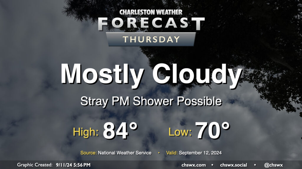
Cloud cover will continue on Thursday as moisture from Hurricane Francine, which has made landfall in Louisiana as a Category 2 storm with maximum winds of 100 MPH, continues to push northward across the Southeast and into the Lowcountry. High pressure will try to hang on across the East Coast, though Francine will continue to dislodge it north and east. Moisture moving atop high pressure will create plenty of clouds and may be enough to get a few showers going in the afternoon as well, though many of us should stay dry for one more day. We start Thursday around 70°, warming to the mid-80s in the afternoon despite the cloud cover.
Friday & the weekend: Rain chances peak
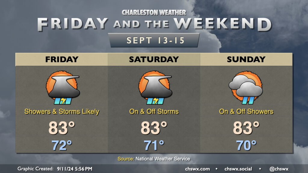
Moisture transport will continue heading into the weekend, and improving lift will allow for showers and a few thunderstorms to develop and become widespread starting Friday and lasting into Saturday. Sunday could be interesting depending on the potential for low pressure to develop offshore and move inland. This will keep elevated shower chances in play at a minimum. There’s a non-zero chance it could briefly become tropical before coming ashore, but we’ll see how that plays out. (It wouldn’t have time to get terribly strong, thankfully.) Temperatures will generally hold very steadily — expect lows in the low 70s each day followed by highs in the low to mid-80s each afternoon.
Tropics: Some intrigue nearby with a stalled front next week
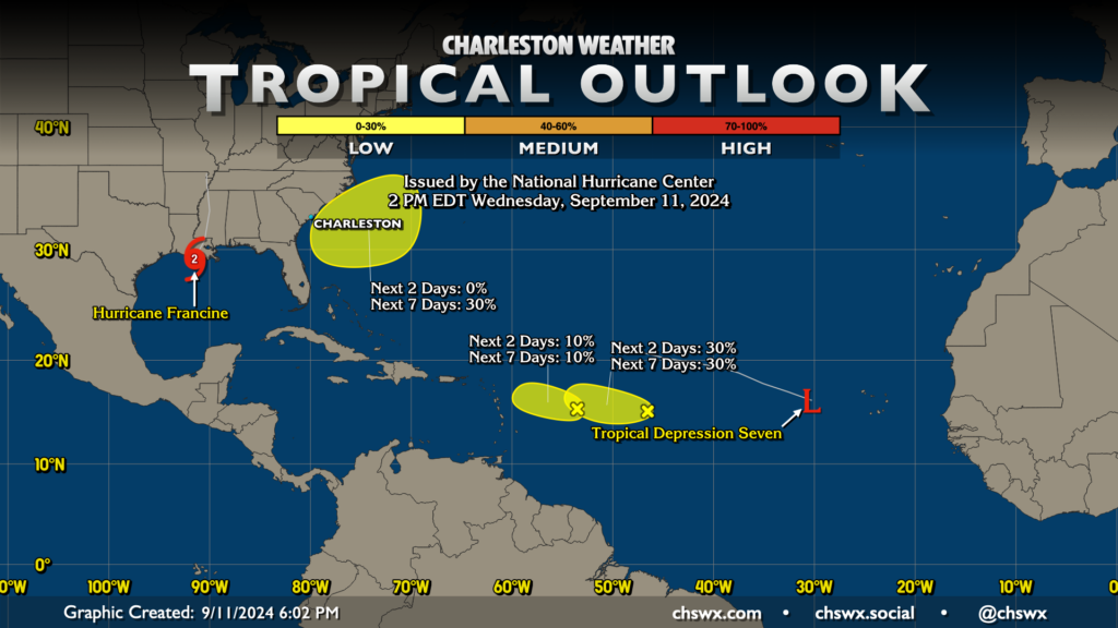
The tropical Atlantic continues to be busy. We have Hurricane Francine making landfall at the time of this writing in Louisiana, Tropical Depression Seven very near the Cabo Verde Islands, and two other low-probability development locations in the central Atlantic.
We’re most interested in the yellow blob near the Carolinas, though, where there’s an outside shot at some homegrown tropical action late this weekend into early next week. A wave of low pressure is expected to develop along the stalled front to our south later Sunday and should approach the coast into Monday. There’s an outside shot that it could make a transition to a tropical cyclone before getting ashore, but we’ll need to wait and see. Regardless of any development, this could be a shower enhancer and could turn things a little more to the breezy side. The good news is that it doesn’t look like it would have enough time to develop into anything that’d make us relocate our decorative cows. We’ll keep an eye on this, but right now, nothing to get overly worried about.
Follow my Charleston Weather updates on Mastodon, Bluesky, Instagram, Facebook, or directly in a feed reader. Do you like what you see here? Please consider supporting my independent, hype-averse weather journalism and become a supporter on Patreon for a broader look at all things #chswx!