Thursday: A few stray storms; quieting down over the weekend
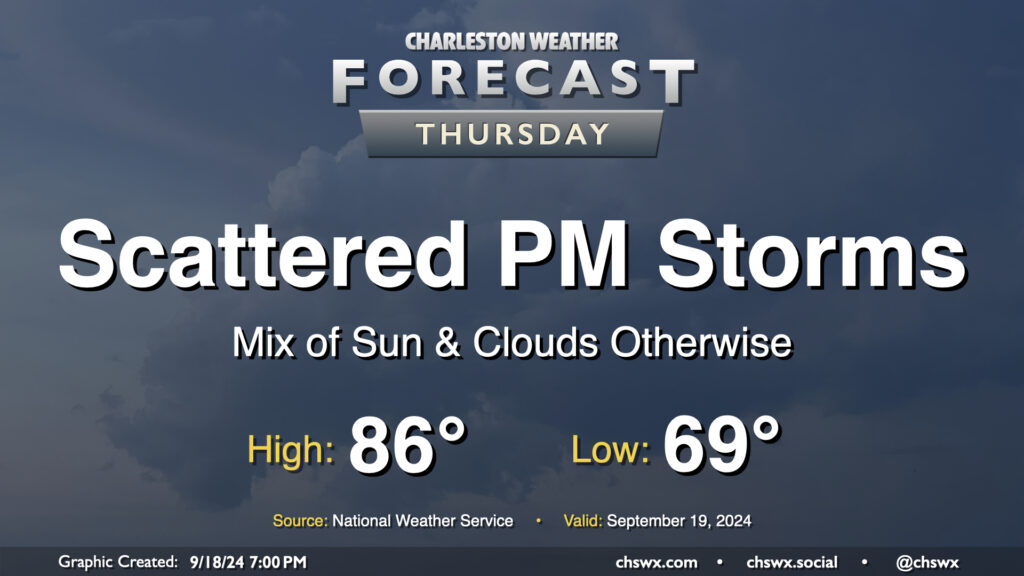
We’ve got one more day of unsettled weather as low pressure aloft and at the surface mosey their way on out of here ahead of what should be a nice weekend. After a generally nice start in the upper 60s, a mix of sun and clouds will send temperatures up to the mid-80s in the afternoon before a few showers and thunderstorms break out with the heating of the day. Not everyone sees rain, but some heavy downpours will be possible in a few spots once again. Severe weather is not expected.
Friday & the weekend: Quieting down, staying warm
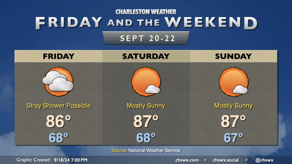
Aside from a stray shower on Friday, we’ve got quiet conditions coming up that’ll stick around for the next few days. Temperatures will generally run in the mid-80s each day — a little warmer than first thought as a ridge aloft builds in a bit more — as mostly cloudy skies on Friday yield to mostly sunny skies starting Saturday. There won’t be any mentionable rain chances for the foreseeable future with the ridge hanging on and high pressure at the surface, too. Beyond the weekend, expect a cooling trend to start to take shape as cooler air builds in from the northeast.
Tropics: A lot of chatter about next week, but what’s the story?
Updated 7:40 PM with information from the 8PM tropical outlook from NHC.
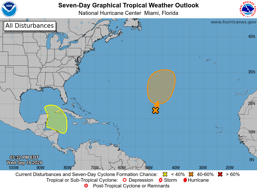
Scary Model Runs have been making the rounds in social media for the past couple days, depicting a tropical cyclone in various locations in the Gulf of Mexico later next week. The range of possibilities as depicted by the operational models runs the gamut across the Gulf, and some have even looked a little interesting for the Lowcountry.
Generally speaking, for several days now we weather nerds have been seeing signals in the longer-range model ensemble that suggest a low pressure system could form in the Bay of Campeche later next week, moving northward into the Gulf of Mexico thereafter. That’s about it as far as what is truly discernible from the guidance in the long-range. A wide variety of solutions, timings, strengths, etc. emerge thereafter. Long story short, details are unknowable at this range, and development is far from a guarantee in the first place.
As always, we look to the National Hurricane Center for actionable guidance on the risk for tropical development. For their part, they have begun highlighting this area with a 30% chance to develop in the next seven days as of today. We’ll keep an eye on model runs, development trends, etc., but for now, there’s no imminent concern for the Lowcountry.
Hurricane season runs through November 30, so it’s important that we stay prepared for whatever might come our way, if anything at all. For now, though, there’s nothing we need to really worry about. If that changes, I’ll let you know.
Follow my Charleston Weather updates on Mastodon, Bluesky, Instagram, Facebook, or directly in a feed reader. Do you like what you see here? Please consider supporting my independent, hype-averse weather journalism and become a supporter on Patreon for a broader look at all things #chswx!