Tuesday: Another quiet and unseasonably warm day while we watch PTC Nine
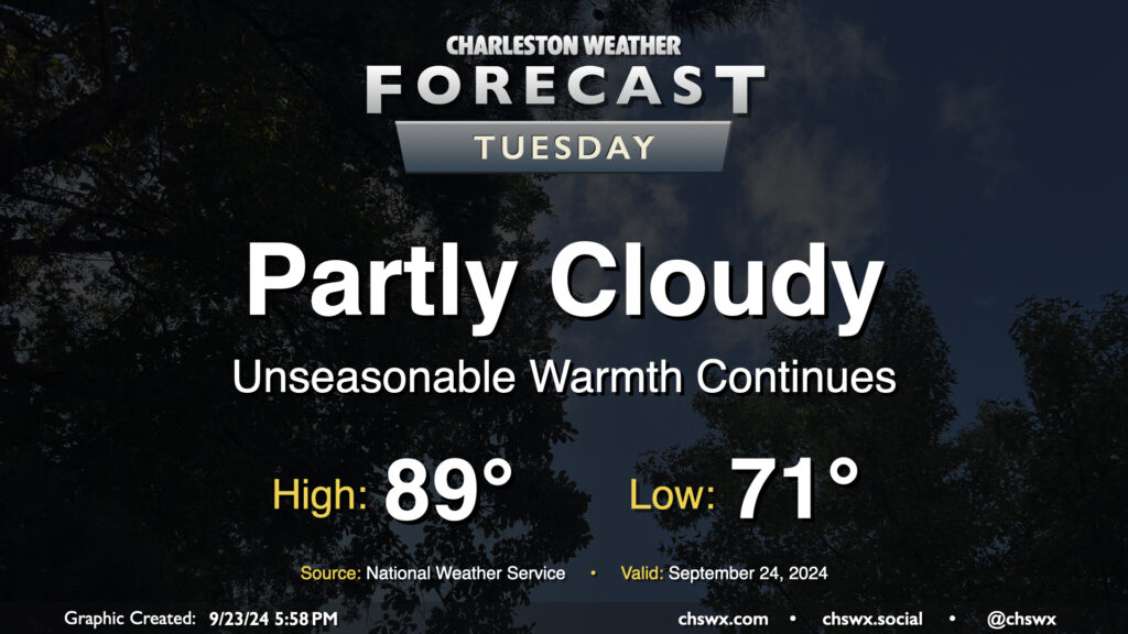
Quiet and unseasonably warm weather continues on Tuesday. Expect to start the day in the low 70s, warming to the upper 80s to around 90° in the afternoon. Dewpoints in the low 70s will yield heat indices in the mid-90s — not necessarily oppressive but certainly unpleasant considering where we are on the calendar. The ridge aloft will keep a lid on any shower activity, so no concerns there as we start to look ahead toward impacts from what is currently Potential Tropical Cyclone Nine later this week.
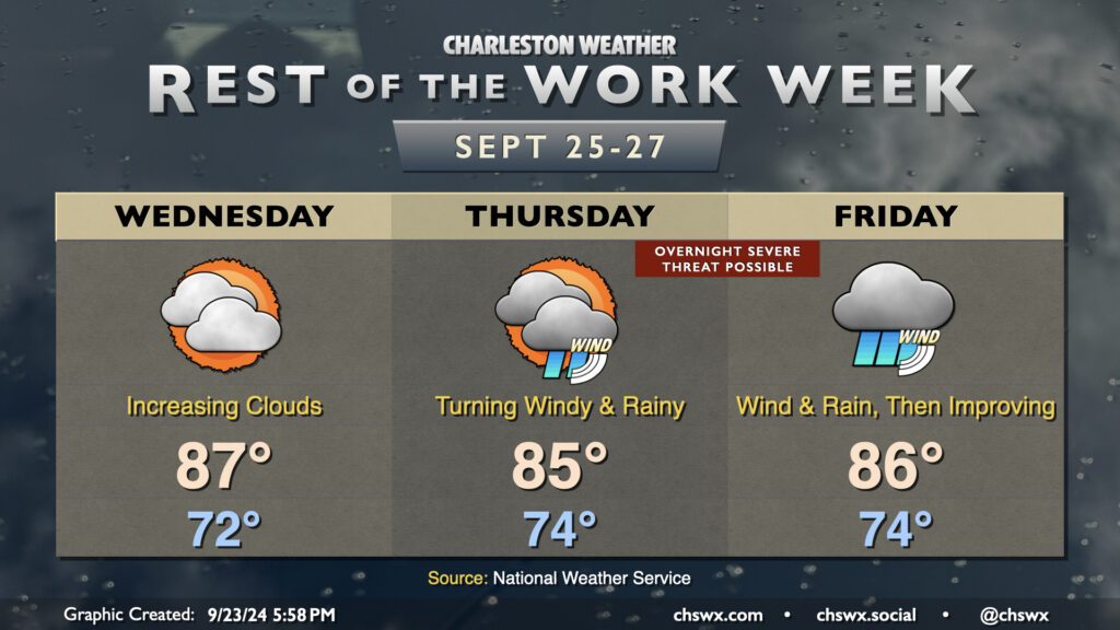
Rest of the work week: Risk for impacts from PTC Nine increasing Thursday into Friday
Potential Tropical Cyclone Nine, which is forecast to intensify into a major hurricane (likely named Helene) before coming ashore along the Florida Gulf Coast on Thursday, increasingly looks like it’s going to play a major role in our weather for the second half of the work week.
Based on the current NHC forecast, which is still subject to significant revisions, we’ll have one more rain-free day Wednesday with clouds increasing over the area as Nine approaches. Expect similar temperatures to the past couple days, with lows in the low 70s yielding to highs in the upper 80s in the afternoon.
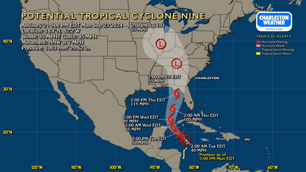
As best as we can tell right now, Nine’s impacts will peak Thursday into Friday. On the present forecast track, Nine will be accelerating northward and intensifying rapidly into a major hurricane by Thursday afternoon. Landfall should take place in Florida Thursday evening, and the fast-moving Nine will spread a decent swath of strong winds inland. Nine’s circulation will be pretty broad, it looks like, and it’s becoming increasingly likely that we will see tropical storm conditions here starting Thursday and lasting into Friday. If there’s one bit of good news, it’s that it will continue to move quickly, so we should be done with it by the weekend.
With the storm tracking to our west, we will be on the stronger eastern side, increasing the risk for coastal flooding, gusty winds, heavy rain bands, and even a few tornadoes. One thing to call out is that on the present forecast track and timing, there may be a nocturnal tornado threat Thursday night into early Friday morning. There’s plenty of room for this timing to change, but we should be getting ready for that possibility while the weather is quiet. Take some time in the next couple days to ensure your weather radio or other alerting device is working properly and that you know what you will do if a tornado warning is issued for your location. (Don’t just rely on your cell phone for this, either!) As we remember from Debby, tropical tornadoes develop quickly, move quickly, and can dissipate just as quickly. They are a pain in the rear for warning forecasters, and can develop without much advance warning. Knowing what you’ll do if a warning is issued ahead of time will help you react quickly and safely.
Periods of heavy rain will be a concern as well, and with the onshore flow, we can expect some degree of storm surge impacts this go-around. The degree to which we see these impacts remains highly dependent on the track. There will be adjustments and refinements to come as more data comes in, so be sure to check back in regularly with forecast updates. Stay tuned to reliable, responsible weather sources over the next few days as these adjustments are made.
Follow my Charleston Weather updates on Mastodon, Bluesky, Instagram, Facebook, or directly in a feed reader. Do you like what you see here? Please consider supporting my independent, hype-averse weather journalism and become a supporter on Patreon for a broader look at all things #chswx!