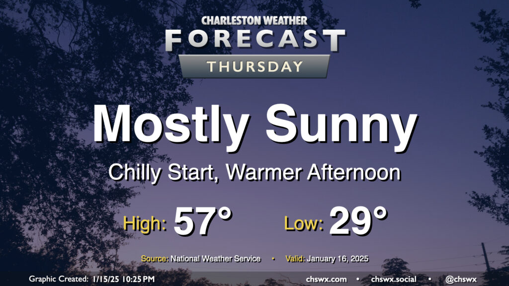
Thursday: Sunshine and a little warmer after a subfreezing start

We start Thursday in the upper 20s to low 30s across the metro, but temperatures will ultimately end up a few degrees warmer than Wednesday under mostly sunny skies. This will be the second to last day of generally quiet weather before an unsettled period begins this weekend and lasts into next week, which will turn very cold and perhaps somewhat interesting winter weather-wise, too.
Friday & the weekend: Turning warmer, but rain arrives, too

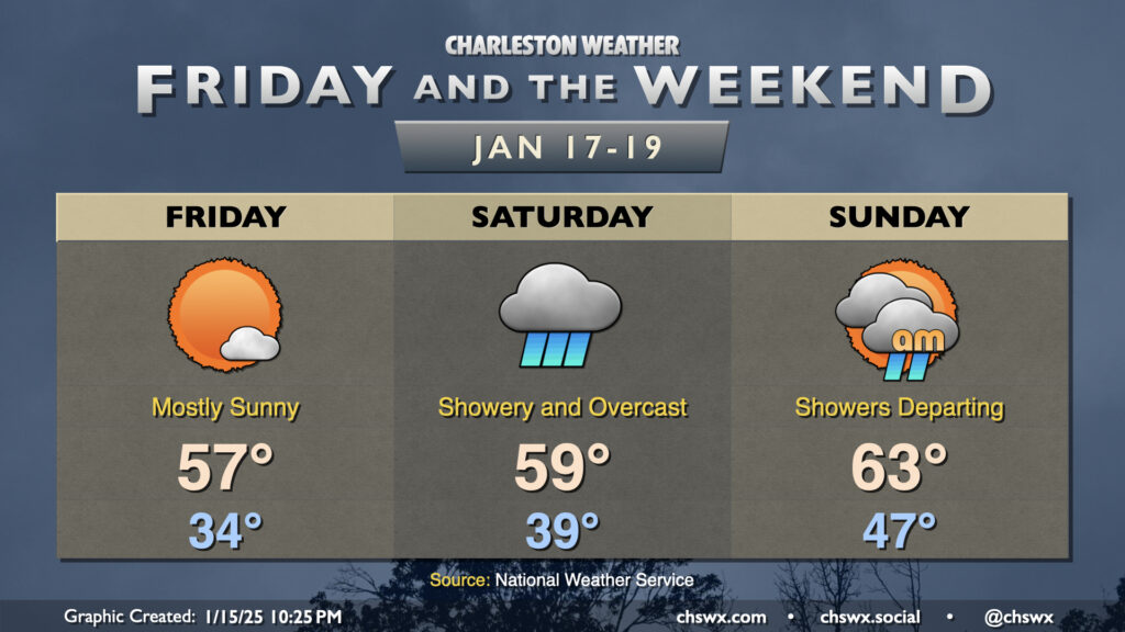
Friday will be a quiet weather day and will have the distinction of starting a few days with temperatures above freezing. Granted, we won’t start very far from it as lows bottom out in the mid-30s, but we’ll take it. Highs once again top out in the mid-to-upper 50s, with mostly sunny skies expected. A few clouds should begin to move in late — a harbinger of things to come.
Saturday turns much more unsettled as a cold front approaches the area. We start the day in the upper 30s to around 40°, warming to near 60° in the afternoon despite the showers and overcast that are expected, especially as we get into the afternoon and evening hours. Indoor activities look like the move as showers are going to be a persistent issue for much of the day.
Expect a few showers in the area overnight Saturday into Sunday morning, though they will be departing as time goes on. Highs on Sunday will peak as high as the mid-60s, but this will be very short lived as the front with the first shot of cool air will move by later in the day. The second shot of cool air arrives overnight Sunday into Monday, setting up a very cold week that could have winter weather implications.
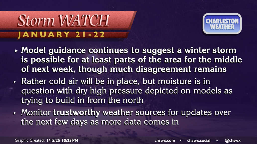
Storm watch: Next Tuesday and Wednesday may feature wintry conditions, but much uncertainty remains

What we know about next week is that it will be cold — some of the coldest air of the season, in fact. What is less clear is if a storm system will get into the mix, bringing in enough moisture for precipitation. Model guidance continues to trend toward a storm system developing in the Gulf early next week, tracking along the Gulf Coast through mid-week. What’s much less clear is the exact path of the storm thereafter, whether it will be far enough north to affect us, and if there will be enough moisture for wintry precipitation. Operational guidance today has run the gamut between a snowstorm, an ice storm, and dry high pressure. Until these inconsistencies are worked out, we’re not going to be able to really tell much about the specifics of what will fall and when it will fall. That being said, given the airmass in place and the pattern we are seeing (which looks an awful lot like last week’s setup that brought some sleet and ice to the area), confidence is improving in at least some winter weather having impacts. Stay tuned to trustworthy, human weather sources — the default phone weather app is just not going to cut it for this kind of event — as more data rolls in and we can better get a handle on what to expect and what actions, if any, you should take.
Follow my Charleston Weather updates on Mastodon, Bluesky, Instagram, Facebook, or directly in a feed reader. Do you like what you see here? Please consider supporting my independent, hype-averse weather journalism and become a supporter on Patreon for a broader look at all things #chswx!