Thursday: Warming trend begins
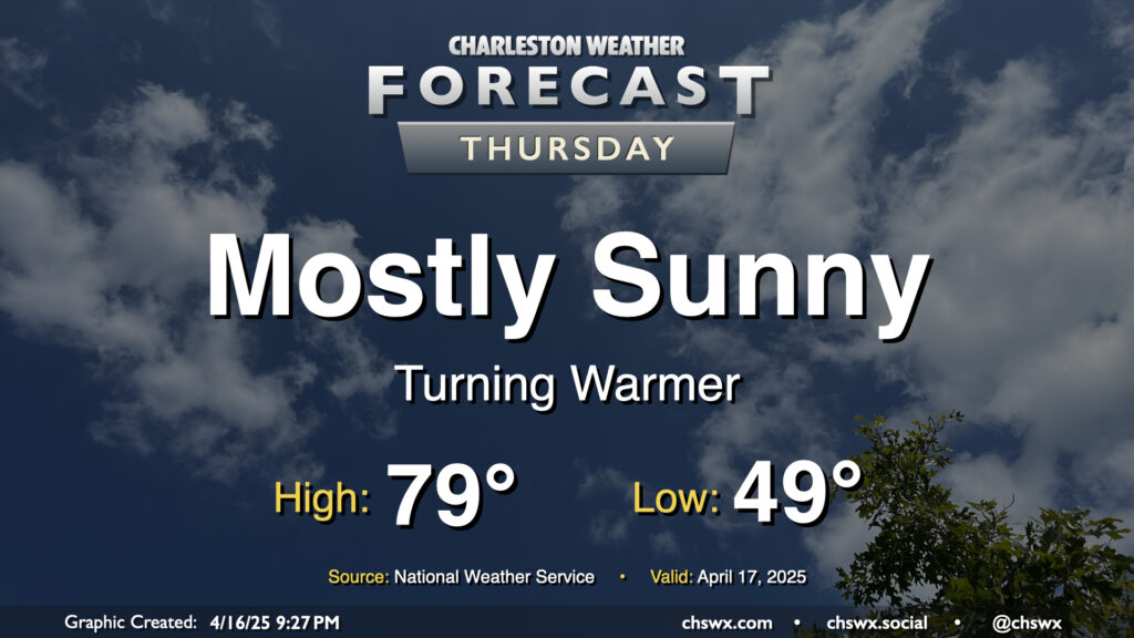
Above-normal temperatures return to the Lowcountry on Thursday as high pressure at the surface begins to head eastward. We’ll start the day in the upper 40s to around 50°, warming to near 80° in the afternoon under mostly sunny skies. I hope you get a chance to get out and about at some point because it should be another nice day!
Friday & the weekend: Warming up a bit more, looking rain-free
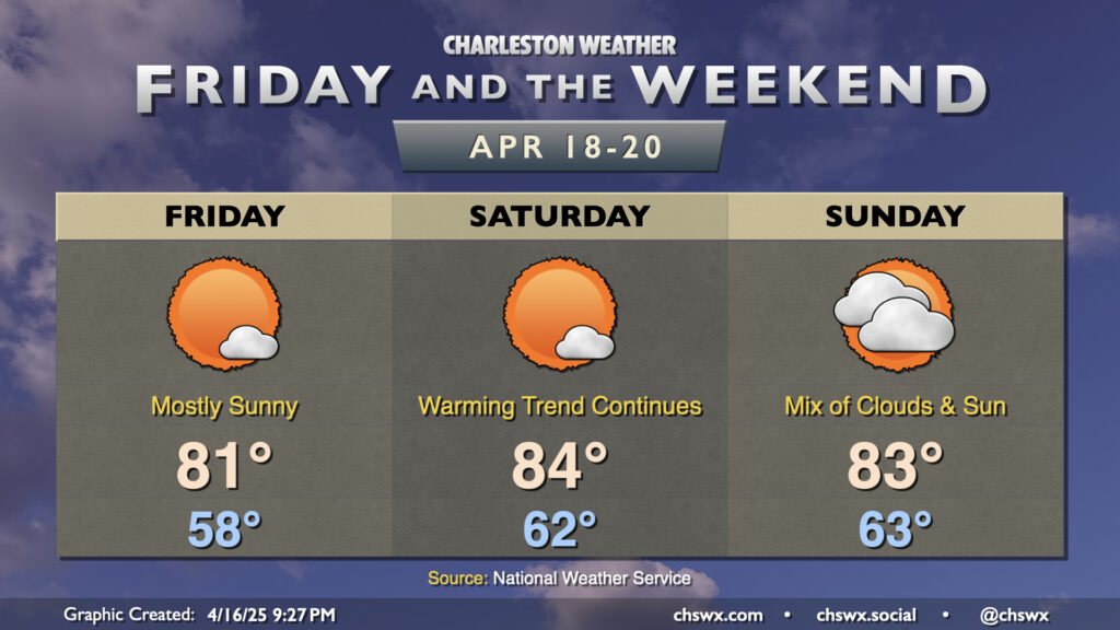
No concerns for Friday and the upcoming weekend in the weather department as temperatures continue to warm. Friday starts much warmer than Thursday did; expect lows in the upper 50s to around 60° in the morning to warm to the low 80s in the afternoon under mostly sunny skies. Saturday will essentially be a copy of Friday with a few more degrees added to the temperature forecast — expect temps to peak in the mid-80s. High pressure begins to lose a little influence on Sunday, which will drive a bit more in the way of cloud cover across the area. Even still, we’ll warm comfortably into the low-to-mid-80s once again.
The next rain chance arrives Tuesday and lingers into at least Wednesday as a front approaches the area and stalls out. Showers and a few thunderstorms are expected, but right now, severe weather is not. If that changes, I’ll let you know.
Follow my Charleston Weather updates on Mastodon, Bluesky, Instagram, Facebook, or directly in a feed reader. Do you like what you see here? Please consider supporting my independent, hype-averse weather journalism and become a supporter on Patreon for a broader look at all things #chswx!