Tuesday: Warm front retreats northward, keeping us toasty
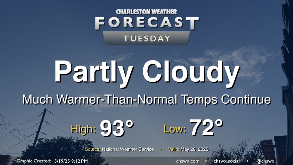
Expect less in the way of cloud cover on Tuesday as the front that helped focus some shower and thunderstorm activity across the area on Monday meanders north and high pressure builds in aloft with plenty of dry, sinking air to be found. We’ll stay on the toasty side of normal for mid-May, with lows in the low 70s warming to the low-to-mid-90s in the afternoon. Dewpoints aren’t terribly out of control, thankfully, so heat indices won’t be too much of a factor, only running about 2-3° or so above the air temperature. That said, it’s still quite warm for this point in the year — the normal high for May 20 is 84°.
Rest of the work week: A few storms Wednesday, then drier (and eventually cooler) air works in
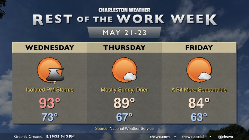
We’ve got a day or two more of above-normal heat before temperatures moderate a bit heading into Memorial Day weekend. Wednesday will be the warmest day of the set, with lows in the low-to-mid-70s warming to the low-to-mid-90s in the afternoon. A front will be headed our way, though, and there’s a chance for a few thunderstorms to come along with it. Moisture will be lacking, though, and so coverage of rain doesn’t look to be terribly widespread.
Once the front is through overnight Wednesday into Thursday morning, we’ll see progressively drier air work its way into the area. We start the day in the upper 60s, a few degrees below where we were on Wednesday. Westerly winds keep highs on the warm side of normal, though, with temperatures topping out near 90° — albeit with dewpoints in the mid-50s, which will be a bit more tolerable than recent days. The drier air will keep cloud cover to a minimum, making for brilliant sunshine across the area throughout the day.
High pressure continues to build in on Friday, and some troughing aloft will finally help get temperatures closer to mid-to-late-May norms. Expect highs on Friday to peak in the mid-80s after starting comfortably in the low-to-mid-60s. Dewpoints will mix out to around 50° during the day, making for comfortable warmth under mostly sunny skies.
Looking ahead: Memorial Day Weekend
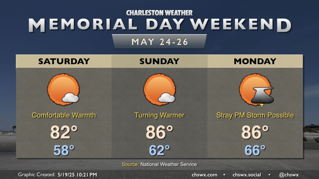
Saturday will run even a touch cooler than Friday did as winds go more northerly; lows in the upper 50s will feel pretty amazing, as will highs peaking in the low 80s with mostly sunny skies. Dewpoints and temperatures begin to climb again on Sunday as high pressure shifts offshore; expect lows in the low 60s to warm to the mid-80s in the afternoon with a slight uptick in cloud cover. As winds go more southerly on Memorial Day, be ready for an isolated storm in the afternoon as highs peak once again in the mid-80s. Doesn’t look like anything near to a total washout, though, so don’t go axing your Memorial Day plans — just stay tuned to forecast updates as timings and rain chances, if any, are refined.