Rest of the work week: Storm chances tick up by midweek
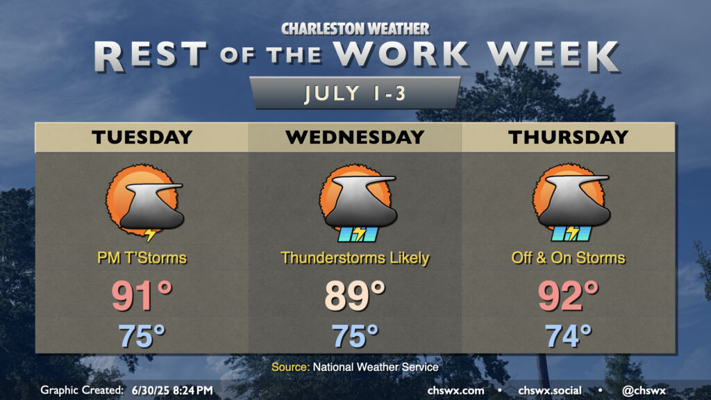
The rest of the work week will turn increasingly stormy as a cold front encroaches on the area by midweek. A trough aloft will help drive the front close to the area — but not quite through — and contribute to an influx in lift and moisture that’ll bring us scattered to numerous thunderstorms, particularly on Wednesday.
Tuesday will be another fairly standard day of weather, though a few more storms will be possible in the afternoon compared to what we saw on Monday. Near-normal temperatures are expected, with a low in the mid-70s warming to the low 90s for the 17th consecutive day.
We may see this streak of 90s get busted up on Wednesday, though, as increasing thunderstorm coverage builds over the area thanks to the aforementioned front. We’ll start the day around 75° once again, with highs looking to top out in the upper 80s to around 90°. Thunderstorms should develop relatively quickly as the heating of the day takes hold, and will become numerous by afternoon. Storm motions will be slow, and rain could be quite heavy at times, so we’ll need to keep an eye out for possible flooding. It won’t rain all day in any one location, but the vast majority of us should record some measurable rainfall.
The front will stall and dissipate around the area on Thursday, though scattered to numerous thunderstorms will continue to be possible. We should be back in the 90s in the afternoon, though, before storms fire and disrupt the temperature curve once more.
July Fourth forecast: Isolated to scattered storms
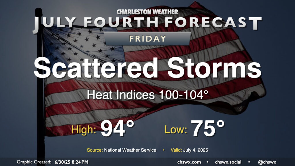
Looking ahead to the Fourth of July, the front will have dissipated and its remnant trough will move offshore. We’ll start the day in the mid-70s once again, warming to the mid-90s in the afternoon. Heat indices should peak between 100-104°, with the warmest apparent temperature in the immediate wake of the seabreeze. A few showers and storms should pop along and ahead of the seabreeze in a traditional summertime setup, but it’s certainly nothing to cancel any July 4th plans over. Just make sure you have a backup plan in case a storm approaches.
Tropics: Stalled front could stir up a low pressure area over the weekend
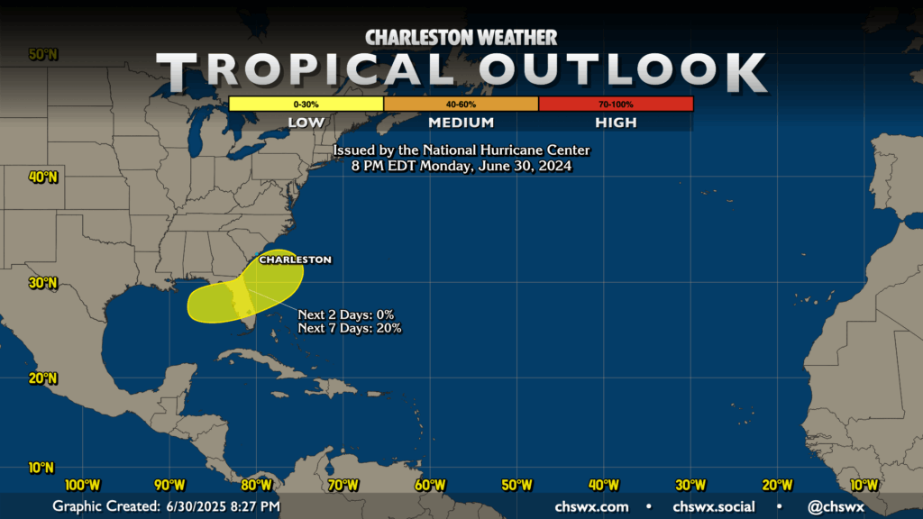
The National Hurricane Center continues to monitor an area stretching from the Gulf through Florida and off the Georgia and South Carolina coasts for possible development along the stalled front. This is a common way to get a tropical cyclone this time of year, but the risk remains at 20%, in the low category for now. Homegrown storms typically aren’t very strong, but can still dump a ton of rain. It remains to be seen just where that rain falls, but for now, we’ll keep an eye on things for perhaps some enhanced rain chances for the weekend into early next week.
Follow my Charleston Weather updates on Mastodon, Bluesky, Instagram, Facebook, or directly in a feed reader. Do you like what you see here? Please consider supporting my independent, hype-averse weather journalism and become a supporter on Patreon for a broader look at all things #chswx!