Forecast: A stormy couple days ahead, but quieting down a bit for the Fourth
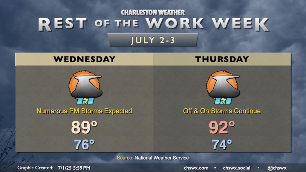
A cold front will draw nearer to the Lowcountry on Wednesday before stalling out, which will help kick up the risk for thunderstorms especially during the afternoon and evening hours. It won’t rain all day, but many of us should measure some rainfall as storms push across the area from west to east through late night. Temperatures in the mid-70s will warm to the upper 80s to around 90°. There’s a chance our 18-day streak of 90°+ highs will come to an end thanks to the proliferation of cloud cover, showers, and thunderstorms on Wednesday, but we will see. Regardless, expect a steamy and eventually stormy day across the metro; be ready for rain to cause some slowdowns.
Thursday is looking a little better, though some storms could linger midday. But drier air will be moving in, and we should see improving conditions by evening. It’ll be another warm day, with highs returning to the 90s in the afternoon after another mid-70s start.
Fourth of July weekend: A bit quieter
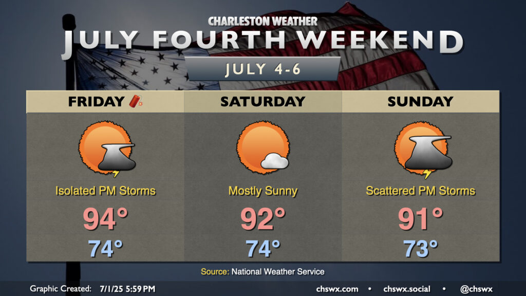
Rain chances continue to trend downward for the Fourth of July, with less coverage expected as high pressure ridges in aloft. We could see a stray popup storm, but overall, much of us get the holiday in without meteorological incident. It’ll be warm, though: air temperatures will peak in the mid-90s, and dewpoints in the upper 60s to around 70° will make it feel like the upper 90s to around 100°. Overall, if you can dodge a stray storm or two, it’s a good day of weather ahead. Just be ready to move indoors if you get convectively unlucky.
Saturday is looking pretty quiet across the metro, with mostly sunny skies and highs in the low 90s expected. A bit more of a scattering of storms is expected on Sunday as a weakness in the ridge develops over the Southeast, but otherwise expect general summer fare to continue with lows in the low-to-mid-70s and highs in the low 90s.
Tropical update: Low — but slightly better — chance for tropical development early next week
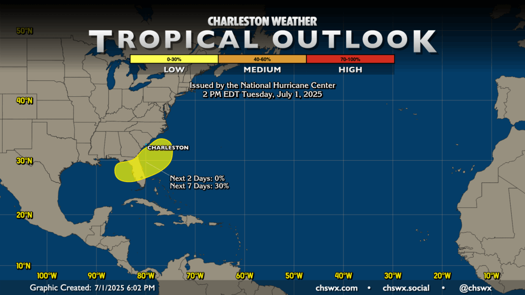
We continue to monitor model guidance for the potential for low pressure — perhaps tropical or subtropical in nature — to develop along the remnants of the aforementioned cold front early next week. The risk has moved up the Southeast coast a bit, but current indications are that anything that forms would be moving eastward and away from the area (but still could act as a bit of a rainfall enhancer). The next name on the list is Chantal. Stay tuned, but don’t lose sleep over this, either.
Follow my Charleston Weather updates on Mastodon, Bluesky, Instagram, Facebook, or directly in a feed reader. Do you like what you see here? Please consider supporting my independent, hype-averse weather journalism and become a supporter on Patreon for a broader look at all things #chswx!