Thursday: Off and on storms persist; weekend forecast turning wetter
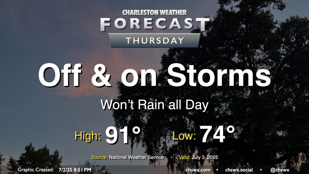
While storms so far on Wednesday were more off than on, more chances for rain arrive on Thursday with the heating of the day and a stalling front that will be in the neighborhood. Temperatures start in the mid-70s, warming to the low 90s in the afternoon — right on the line for what to expect from early July. Showers and thunderstorms will be capable of heavy rain and frequent lightning, and an isolated severe storm can never be ruled out this time of year where boundaries collide.
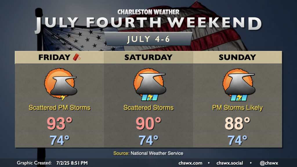
Fourth of July weekend: Forecast turning wetter as we watch for possible tropical development
The forecast is looking a little wetter for Independence Day Weekend, unfortunately, as models are increasingly hinting at low pressure development off the Southeast coast.
The Fourth of July itself will still fall into a regular summertime pattern, with slightly drier air moving into the area to keep more widespread storm chances tamped down. Lows in the mid-70s in the morning warm to the low-to-mid-90s in the afternoon, with heat indices running just a couple degrees above the air temperature. It’ll still be hot, but quite as bad as we have gotten in early Julys of yore. Be alert to changing conditions Friday afternoon, and be prepared to bring your outdoor plans indoors if thunderstorms approach.
Moisture begins to tick back up a bit Saturday, and the developing low pressure could sling some showers ashore in addition to anything that pops up away from the coast. Overall, off and on storms are possible Saturday, with highs peaking around 90°. Not everyone will see rain, and it won’t rain all day at any one location.
Shower and thunderstorm chances increase Sunday as low pressure draws nearer. How much rain will fall is the question, and a lot of this will be dependent on the track of the low. Guidance generally keeps the heaviest rain well offshore, but this assumes a track that keeps the low to our east. We’ll see how this shakes out — need the thing to really form up first — but it stands to reason it could be an unsettled couple days of weather at the coast.
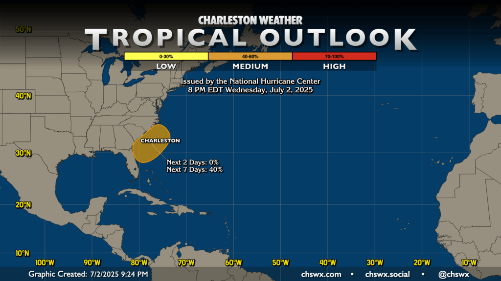
NHC has continued to highlight an area off the Southeast coast, including the coastal Carolinas, for the potential for tropical development over the next few days. Right now, NHC gives the area 40% odds — increased slightly from yesterday afternoon, but holding steady since yesterday evening — that low pressure that forms here takes on at least some tropical characteristics. We’ll see how this shakes out, but right now, we shouldn’t expect anything particularly strong to come out of this, and it’s far from anything to panic over (even if it does get named). The next name on the list is Chantal after Andrea and Barry both had relatively short lives as tropical cyclones.
Follow my Charleston Weather updates on Mastodon, Bluesky, Instagram, Facebook, or directly in a feed reader. Do you like what you see here? Please consider supporting my independent, hype-averse weather journalism and become a supporter on Patreon for a broader look at all things #chswx!