Tuesday: A bit unsettled, a bit warmer
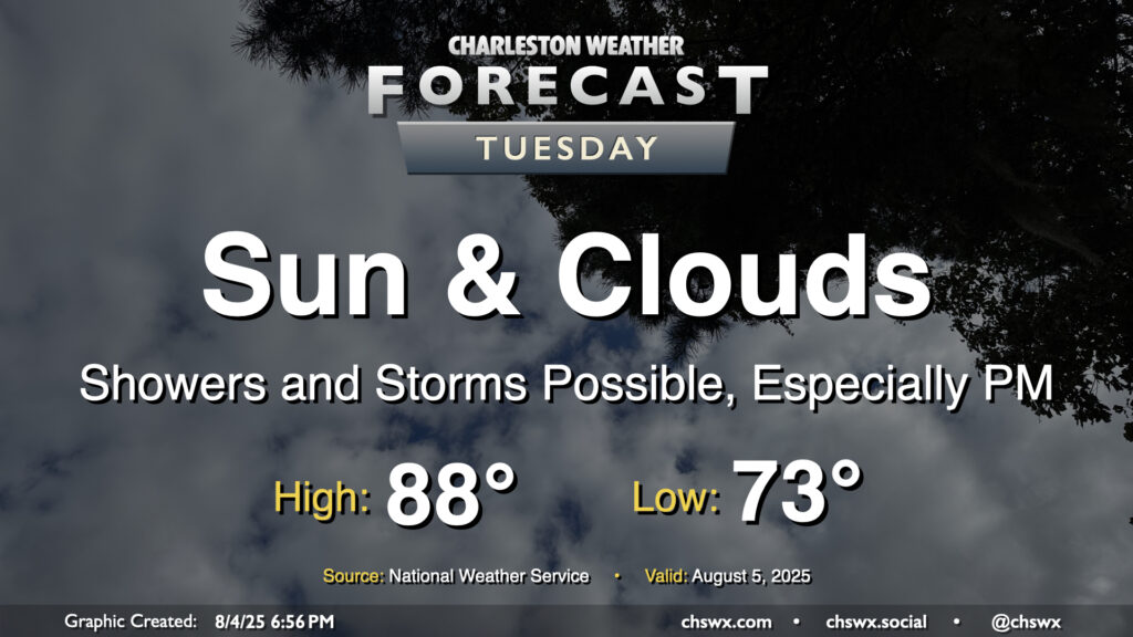
We remain on the cool side of normal on Tuesday, though a few more breaks in the clouds should allow temperatures to turn warmer, with highs approaching the mid-to-upper 80s in the afternoon after starting the day in the low 70s. Periods of showers and maybe a few thunderstorms will continue to be possible, though it won’t rain all the time. Some guidance suggests storms kicking off on the seabreeze later in the afternoon, which could produce some heavy downpours considering the continued feed of moisture and energy from the southwest. Severe weather is not expected, though.
Rest of the work week: More of the same; watching possible low pressure for late week
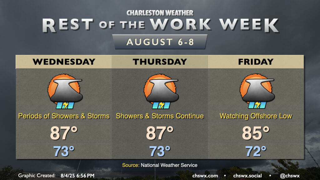
Periods of showers and storms interspersed with quiet conditions look to continue this week as the stalled front continues to linger to the south and offshore. Places near the coast and to the south of the Charleston metro generally have the best shot at some heavier downpours with thunder, while drier air inland tries to hold on. Lows will remain steady in the low 70s each morning, while highs will continue to peak on the cool side of normal in the mid-to-upper 80s each day.
As we head closer to the weekend, we’ll be keeping an eye on the potential for a wave of low pressure to develop along the stalled front with possible tropical implications. This low pressure area makes the late week/weekend forecast a little more uncertain, given significant model differences in where it forms and where it ultimately ends up. NHC is giving this area a 30% chance to develop in the next seven days. (More on the tropics in a minute.) Whatever gets going won’t be terribly extreme, but could still be a decent rainmaker, so we’ll watch it.
Tropical update: Dexter forms, eastern Atlantic starts to wake up
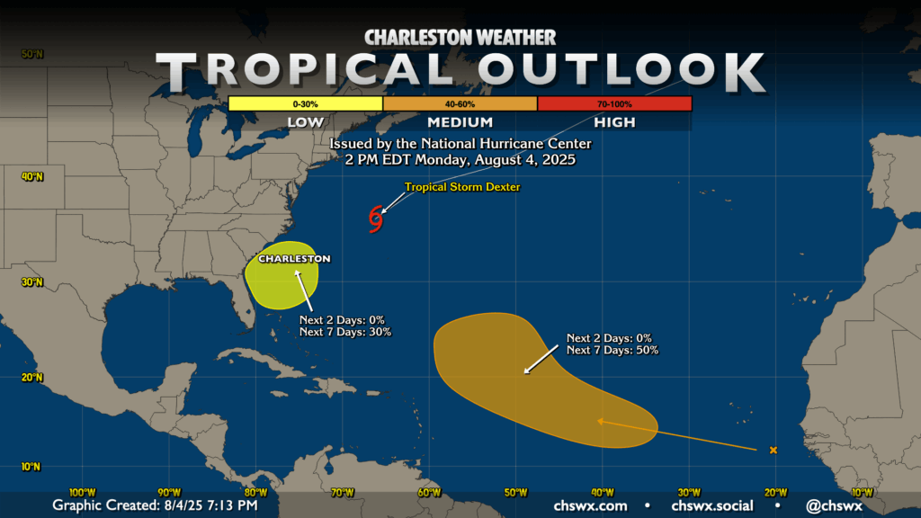
Late last night, Tropical Storm Dexter developed along the eastern extent of the stationary front that bends around to our south and is responsible for our cooler-than-normal weather. It’s moving away from the continental US and won’t be a concern beyond shipping traffic.
In addition to the aforementioned area off the Southeast coast, NHC is also watching a tropical wave off the coast of Africa for development later this week. The risk for development is up to 50% for this wave, with NHC painting an area between 34°W and 60°W for it to become a tropical cyclone. Right now, recurvature seems to be the most likely outcome, but we’ll watch it all the same.
Follow my Charleston Weather updates on Mastodon, Bluesky, Instagram, Facebook, or directly in a feed reader. Do you like what you see here? Please consider supporting my independent, hype-averse weather journalism and become a supporter on Patreon for a broader look at all things #chswx!