Tuesday: Back to heat
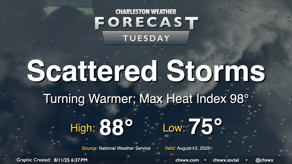
After a rambunctious Monday that featured widespread showers and thunderstorms leading to flash flooding downtown as well as a lightning strike caught on camera in Mt. Pleasant, the weather will return to a more traditional summertime pattern beginning Tuesday as Charleston County heads back to class. Temperatures will start on the mild side, generally in the mid-to-upper 70s, warming to the upper 80s in the afternoon. Mix in the continued humidity, and it’ll feel closer to 98°. Scattered showers and storms should fire again in the afternoon along and ahead of the seabreeze, and yes, there is a risk of heavy rain with these storms, but the risk for flash flooding will be a bit lower especially as storm motions should be a bit faster.
Rest of the work week: 90s return
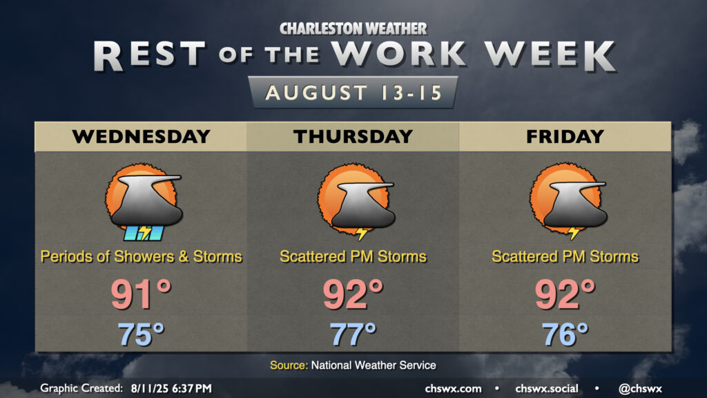
After a week-plus of sub-90° temperatures, summer returns by mid-week with temperatures that are closer to, if not slightly above, mid-August normals. Generally, we can expect lows in the mid-to-upper 70s each morning, with highs peaking in the low 90s each afternoon. Mix in the humidity and you’ve got a recipe for heat indices generally 100-105° at peak heating. Scattered storms should fire along and ahead of the seabreeze in the afternoons, bringing some relief, but also with the risk for a strong storm or two and isolated heavy downpours. We’ll keep this pattern going into the weekend — no washout, but still dodging a few storms at times, as is custom. (Nothing like this past weekend, though!)
Tropics: Tropical Storm Erin forms; likely the season’s first hurricane later this week
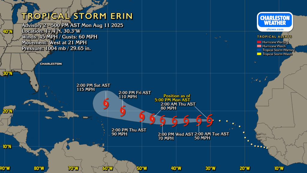
Tropical Storm Erin was christened earlier today near the Cabo Verde Islands, where it has already caused flooding and even a few deaths before gaining tropical classification. Erin is right around 30°W, moving westward at 21 MPH. The forecast track generally keeps it heading westward this week, gathering strength as it goes. The 5PM NHC intensity forecast has it becoming a hurricane late Wednesday/early Thursday, and strengthening into a major hurricane by the weekend.
Models are pretty tightly clustered through Thursday, but from there, they diverge as there are questions around how Erin interacts with a weakness in high pressure in the western Atlantic. The odds favor recurve at this point, but we’ll keep an eye on things all the same. Nothing to worry about right now here at home, but a good reminder all the same that we’re headed into the peak of hurricane season and that preparedness is the key to getting through it successfully.
Follow my Charleston Weather updates on Mastodon, Bluesky, Instagram, Facebook, or directly in a feed reader. Do you like what you see here? Please consider supporting my independent, hype-averse weather journalism and become a supporter on Patreon for a broader look at all things #chswx!