Thursday: Warm with a few storms
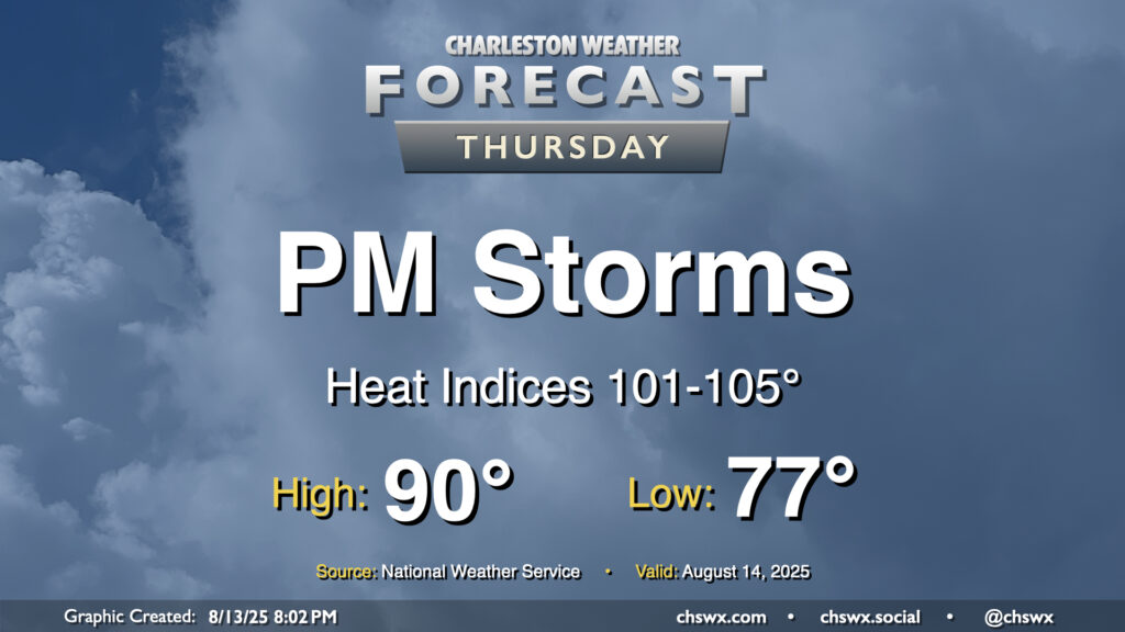
Thursday will be a fairly typical mid-August day across the area. We’ll start in the mid-to-upper 70s, warming to around 90° in the afternoon with heat indices generally running in the low to mid-100s given continued dewpoints in the mid-to-upper-70s, highest downtown and along the coast with closer proximity to the water. Once again, showers and thunderstorms should fire on the seabreeze in the afternoon, and a couple of those could be on the strong side with frequent lightning and gusty winds. Winds out of the west will drive showers and storms coastward, so keep an eye on this if you’re taking a day at the beach (you lucky duck).
Friday & the weekend: Still warm, with a little less storm coverage for Sunday
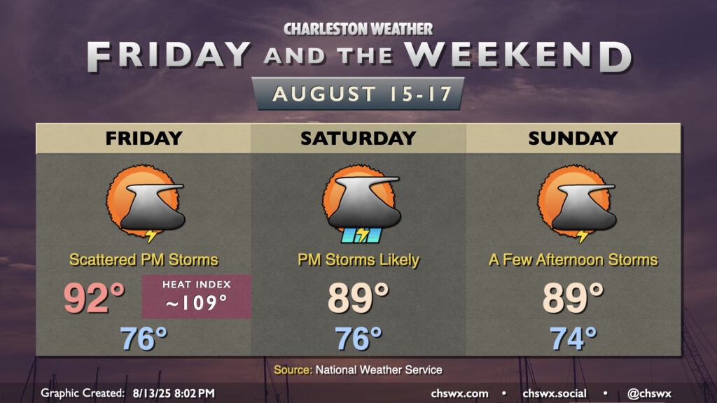
Friday and the weekend will offer a lot of the same weather that we’ve seen the past couple days, with varying degrees of warm temperatures and coverage of afternoon thunderstorms. Friday will be the warmest of the set, with highs in the low 90s combining with mid-to-upper 70s dewpoints to yield heat indices approaching 109°, especially closer to the coast. This is in Heat Advisory territory, and we may end up with one for Friday afternoon. Convective relief from the heat on Friday is a little less likely, too, as we’ll be more reliant on the seabreeze to kick off afternoon thunderstorms.
A weakening front will sag into the area on Saturday, and this should offer a bit more of a trigger for showers and thunderstorms Saturday afternoon. This, in turn, should knock high temperatures down a couple degrees — generally running in the upper 80s to around 90°. Northeasterly winds continue into Sunday, which will usher in slightly cooler and drier air, albeit with a chance for scattered storms in the afternoon (though we shouldn’t see nearly as much coverage as we did on Saturday). We’ll keep this going into next week, with low chances for afternoon storms and highs generally running around 90°.
Tropics: Erin gets better organized
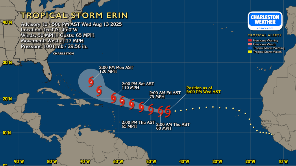
Tropical Storm Erin is moving into more favorable conditions in the central Atlantic, and it is responding with some gradual intensification. Winds are up to about 50 MPH with higher gusts as it is steered around high pressure to the north. It’ll become the season’s first hurricane by Friday, and should become a major hurricane this weekend as it moves to the west-northwest. Guidance trends have continued to point to the storm recurving off the East Coast, thankfully, but not before potentially bringing the Leeward Islands and Puerto Rico some unsettled weather. Still, Erin will be in position to drive up the risk for rough surf and rip currents early next week, so beachgoers will want to be cautious around the water. We’ll continue to keep an eye on Erin as we head into the weekend.
Follow my Charleston Weather updates on Mastodon, Bluesky, Instagram, Facebook, or directly in a feed reader. Do you like what you see here? Please consider supporting my independent, hype-averse weather journalism and become a supporter on Patreon for a broader look at all things #chswx!