Tuesday: Pleasant weather continues
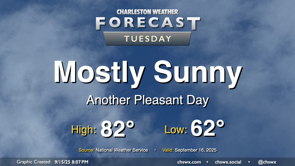
There’s not too much to write home about weather-wise for Tuesday other than it will be a really nice mid-September day across the Lowcountry. Below-normal temperatures continue, with lows in the low 60s warming to the low 80s in the afternoon under mostly sunny skies. Dewpoints mix down to the mid-50s in the afternoon, making the warmth comfortable. Plus, water levels will fall short of flood stage Tuesday as we get further away from the full moon and the recent perigee, so there are no coastal flooding concerns for the rest of the week, either.
Rest of the work week: Turning warmer
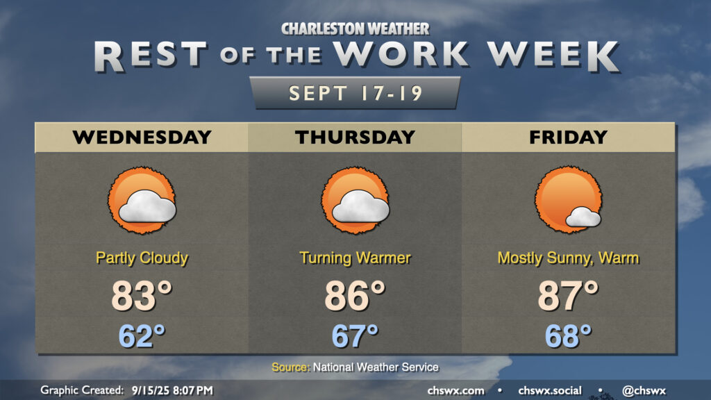
We’ll see a warming trend kick off as we get into the second half of the work week as high pressure ridges in aloft. We’ve got one more really comfortable day ahead for Wednesday, though, with lows in the low 60s one more time and highs peaking in the low-to-mid-80s once again under partly cloudy skies. From there, dewpoints begin to tick up as the prevailing low-level flow turns a little more southerly. We’ll feel it Thursday morning as lows only bottom out in the mid-to-upper 60s, while highs peak solidly in the mid-80s. We will make a run into the upper 80s on Friday after a warmer start in the upper 60s to near 70°. Still, the ridging aloft will keep the risk for rainfall to a dull roar. This should persist into Saturday before we start to see a little more in the way of isolated to scattered afternoon showers and storms starting Sunday.
Tropics: Development expected soon in the Atlantic, but likely nothing to be concerned over
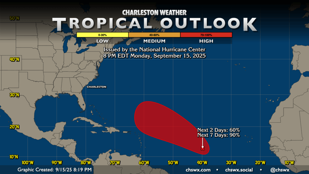
A tropical wave looks increasingly likely to develop into a tropical cyclone heading into the next few days as it moves west-northwest across the Atlantic. NHC gives it a 60% (or medium) chance to develop in the next two days, with a 90% chance to develop in the next seven. Model guidance continues to point to the storm heading west-northwest for a few days before turning northward around a weakness in the Atlantic ridge, avoiding the East Coast of the continental United States (though Bermuda will want to keep an eye on this one). If that changes, we’ll let you know, but all in all, there’s not much to write home about otherwise, tropically-speaking.
Follow my Charleston Weather updates on Mastodon, Bluesky, Instagram, Facebook, or directly in a feed reader. Do you like what you see here? Please consider supporting my independent, hype-averse weather journalism and become a supporter on Patreon for a broader look at all things #chswx!