Tuesday: Turning warmer, with a stray shower or two possible
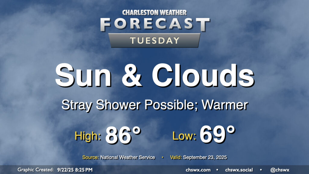
A warming trend begins Tuesday as high pressure to the north continues to weaken and winds turn more onshore, ushering in a much more summer-like feel over the next few days. Temperatures Tuesday start in the upper 60s to around 70°, warming to the mid-80s in the afternoon with a mix of sun and clouds. Factor in the upper 60s-lower 70s dewpoints and it’ll feel more like 90°. Like we saw on Monday, a few afternoon showers are possible, though the weakening high also will portend a weakening coastal trough, which should keep the risk for showers relatively low.
Rest of the work week: Summertime feel continues
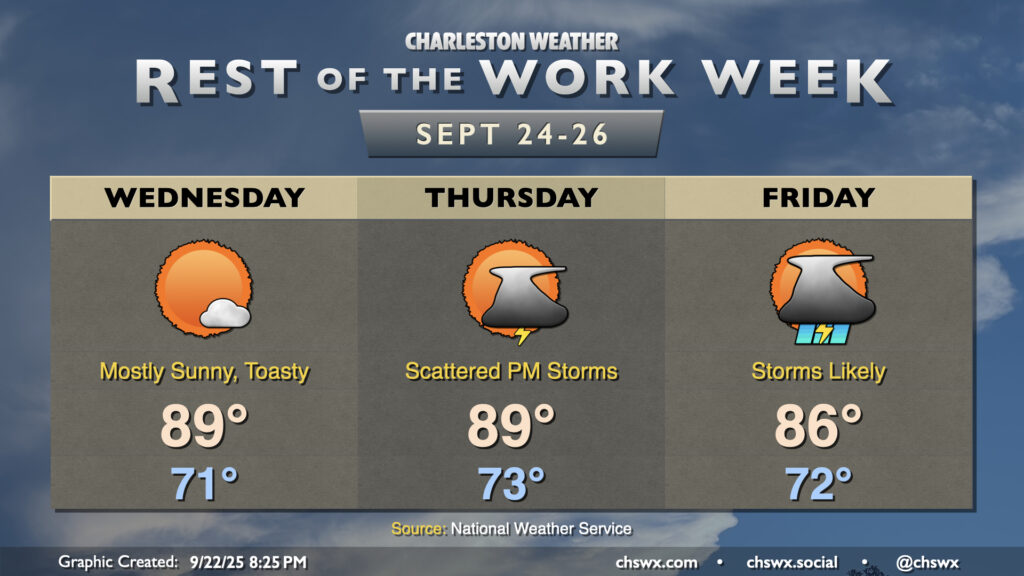
The warming trend peaks Wednesday and Thursday as highs peak in the upper 80s to near 90°, well above normal for this point in the year (normal is generally around 84°). Southerly flow will keep dewpoints in the low 70s, making for heat indices in the low 90s. Lows will also be much warmer than normal, running generally in the low 70s — more in tune with early August rather than mid-September.
While we look to remain rain-free with high pressure at the surface and aloft on Wednesday, an approaching front will start to stir up rain chances starting Thursday afternoon and evening, with storms likely on Friday as the front draws ever-nearer. It’s hard to fathom saying this after the flooding deluges of just a few weeks ago, but we could use some rain. (We’re even getting into the abnormally dry category on the Drought Monitor along and inland of 17 in Berkeley and Dorchester counties!) Right now, it doesn’t look like flooding will really factor in, though we could see one or two decently strong thunderstorms especially Friday.
Tropics: Gabrielle rapidly intensifies; two other areas to watch
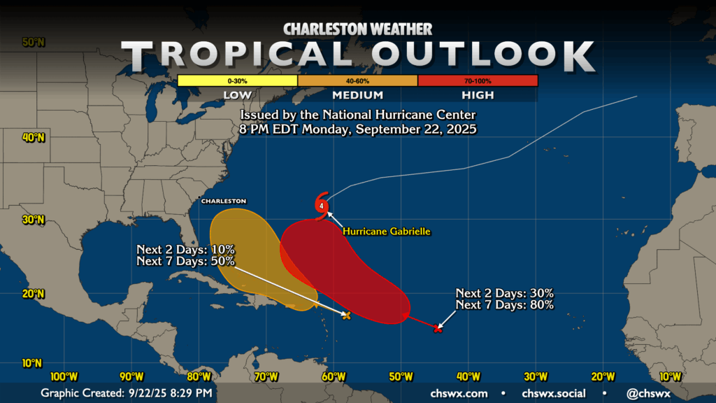
Hurricane Gabrielle rapidly intensified today to major hurricane status. As of the 5PM advisory, it was packing 140 MPH maximum sustained winds — Category 4 on the Saffir-Simpson Wind Scale — with a minimum central pressure of 948mb. Gabrielle will not be a significant threat to land as a tropical cyclone, though it could bring some squally weather to the Azores later this week.
NHC continues to watch two other areas of note. The first one, centered around 44°W, has an 80% chance of becoming a tropical cyclone this week. It should generally follow in Gabrielle’s footsteps and recurve away from the East Coast.
The second area, which is approaching the Leeward Islands, has a 50% chance to develop over the next week. Models continue to not be quite as bullish with this one, but given its closer proximity, it remains something for us to keep tabs on. For now, though, there are no imminent threats, and the prevailing upper-air pattern suggests that if something does form, it should turn northward before reaching the East Coast. We’ll watch both of these and keep you posted in case one or both become anything to be concerned about.
Follow my Charleston Weather updates on Mastodon, Bluesky, Instagram, Facebook, or directly in a feed reader. Do you like what you see here? Please consider supporting my independent, hype-averse weather journalism and become a supporter on Patreon for a broader look at all things #chswx!