Tuesday: Turning breezy, still on the cloudy side with a few showers
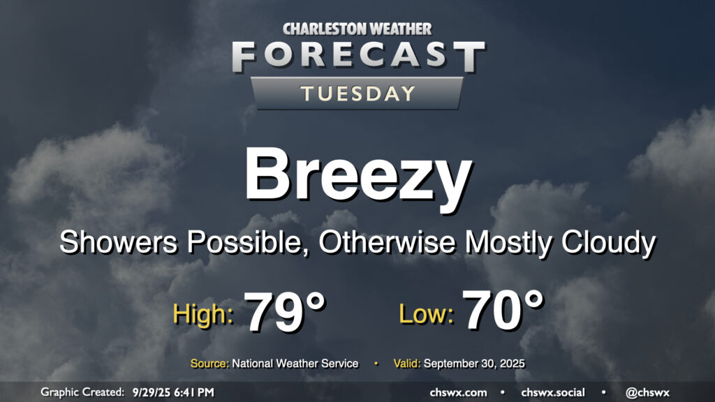
The pressure gradient between high pressure to the north and Imelda to the southeast will be tightening on Tuesday, and we should have a fairly breezy and seasonably cool day once again thanks to those northeast winds as well as cloud cover and a few lingering showers. Temperatures start around 70°, but should only warm to the upper 70s to maybe 80° depending on breaks in the clouds. The decaying coastal front will still be able to contribute to a few showers, but we should see shower chances diminish as we get through Tuesday and Imelda pulls further and further offshore.
There’s a chance that we could see some minor tidal flooding Tuesday afternoon courtesy of elevated water levels due to the onshore, northeasterly flow. The better chances for coastal flooding will begin Wednesday, though, and may be with us for a little bit as we head toward a full moon next week.
Tropics: Imelda strengthens as Humberto clears the path for its escape
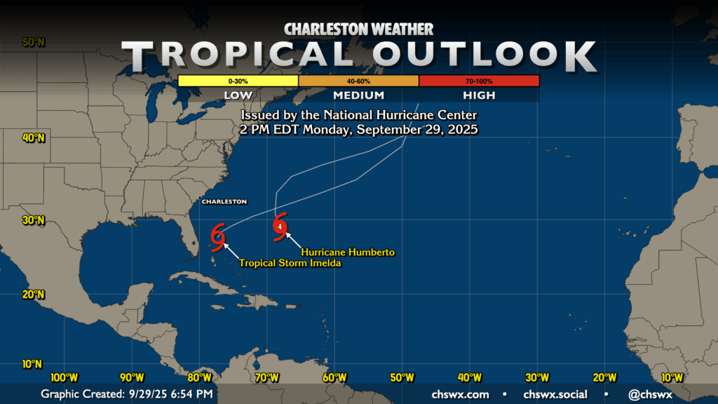
The tropical map continues to feature Imelda and Humberto as they start to get closer and begin to interact. Humberto may be getting weakened a bit by Imelda, but is still expected to carve out a path for Imelda’s easterly turn that will, unfortunately, find it arriving in Bermuda as a hurricane in a few days. We’ll continue to feel coastal impacts from both Humberto and Imelda in the form of strong rip currents and rough surf, so only go in the water if you really know what you are doing. Otherwise, there aren’t any other areas of interest in the tropics, which is fine by me.
Rest of the work week: High pressure builds back in, turning us a little cooler
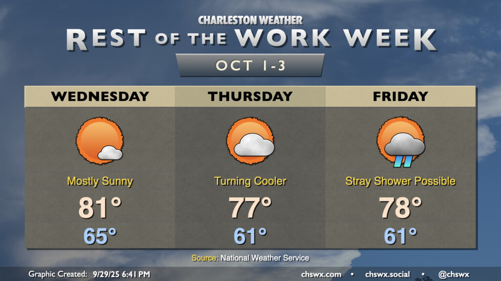
Clouds will break up for the most part by Wednesday, yielding a rather nice start to October with lows in the mid-60s warming to the low 80s in the afternoon. We’ll have a residual breeze with the tight pressure gradient between Imelda and building high pressure, but otherwise, it’s looking pretty good. Cooler and drier air continues to infiltrate into the area, giving us a really comfy start on Thursday with lows in the low 60s in the metro (some folks may dip into the upper 50s) with highs peaking in the mid-to-upper 70s under partly cloudy to mostly sunny skies. A trough of low pressure will start to take shape near the coast, though, and this could fling a few showers our direction on Friday. Otherwise, expect another generally comfortable day with lows in the low 60s and highs in the upper 70s. The only major weather concern will be coastal flooding, with minor flooding in the forecast for Wednesday afternoon and Thursday evening (perhaps around rush hour). Coastal flooding may continue to be an issue as we head into the weekend and next week due to the upcoming full moon at perigee. Stay tuned for possible Coastal Flood Advisories from the National Weather Service.
Follow my Charleston Weather updates on Mastodon, Bluesky, Instagram, Facebook, or directly in a feed reader. Do you like what you see here? Please consider supporting my independent, hype-averse weather journalism and become a supporter on Patreon for a broader look at all things #chswx!