Thursday: A pleasant, fall-like day
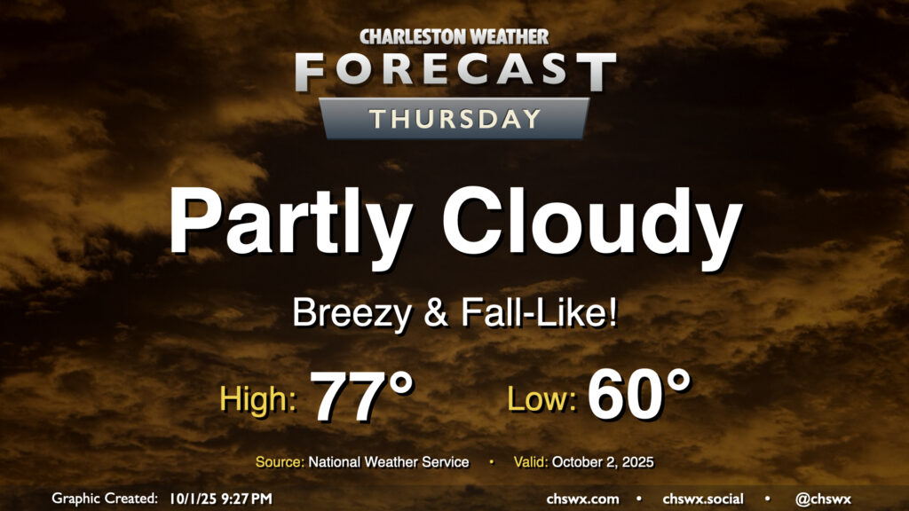
Thursday will give us a really nice taste of fall as cool high pressure wedges southward into the area. We’ll start the day with temperatures around 60°, warming to just the mid-70s under partly cloudy to mostly sunny skies. The northeasterly breeze will still be somewhat elevated, which may contribute to some minor tidal flooding around the 4:45 PM high tide. Otherwise, it’ll be an enjoyable day to get outside and touch some grass.
Friday & the weekend: Some rain chances sneak back in
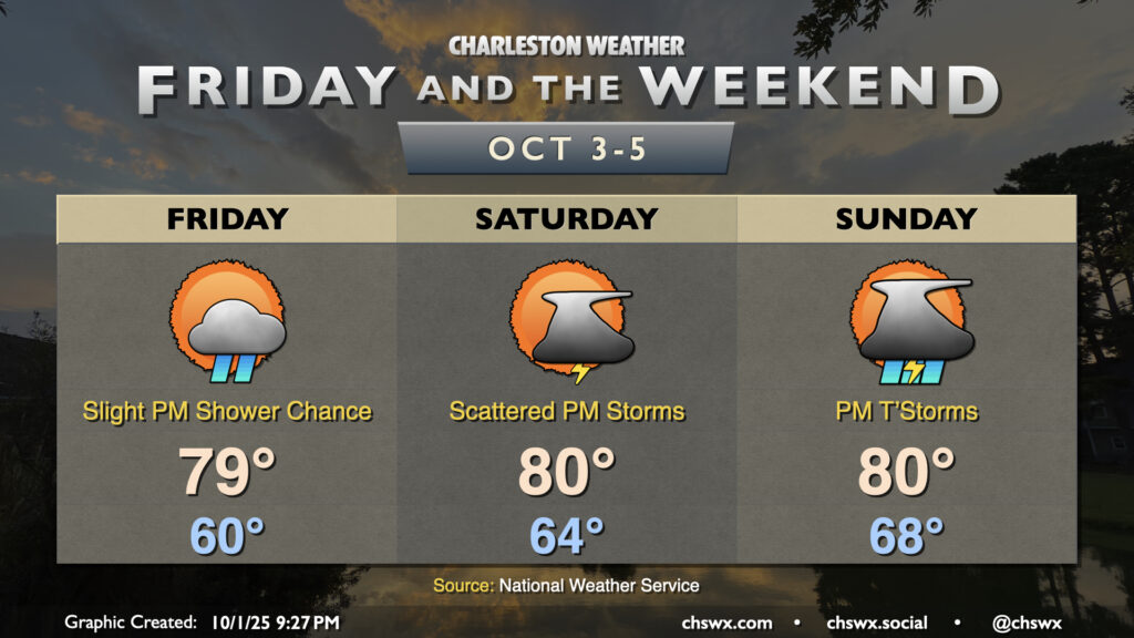
A sharpening coastal trough aided by some energy aloft will bring some rain chances back into the forecast for Friday and the weekend. A few showers will be possible Friday afternoon and again on Saturday with the potential for some thunder. Shower and storm chances tick up a little more for Sunday as the trough moves inland, and a little more humid air moves back in.
We’ll stay on the cool and somewhat breezy side with winds out of the northeast, and this will continue to drive the risk for minor coastal flooding with the late afternoon and evening high tides. Temperatures will still be on the cool side of normal; expect another morning of seasonably crisp lows around 60° on Friday before warming to the upper 70s in the afternoon. We return to the low 80s for Saturday and Sunday, with low temperatures heading up to the mid-60s Saturday and upper 60s on Sunday, indicative of the warmer and more moist airmass that’ll be moving back in.
Tropics: Imelda reaches Bermuda; another area to watch later this week
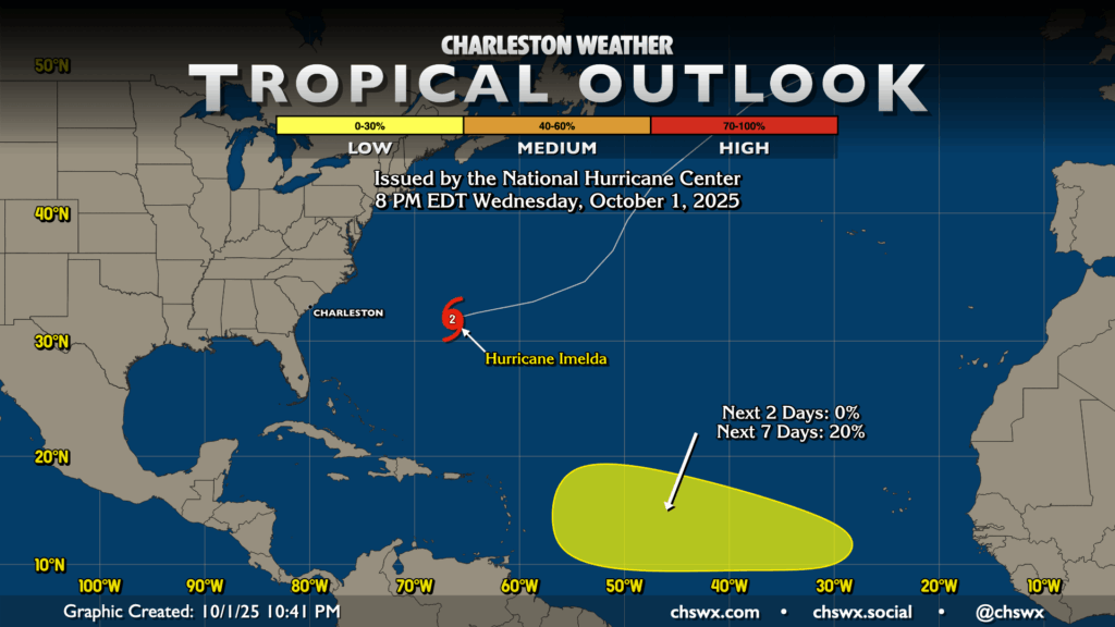
Imelda continues to move out to sea, but not before bringing hurricane conditions to Bermuda including strong winds, heavy rain, and rough surf. It’s packing 100 MPH winds and is moving quickly ENE at 24 MPH. It’s starting some interaction with a front that will aid it in transitioning to an extratropical cyclone over the next few days.
Elsewhere in the tropics, NHC is highlighting an area between the Cabo Verde Islands and the Leeward Islands where a wave that’s yet to emerge from the coast of Africa has a slight chance to develop later in the week/early next week. We’ll keep an eye on it, but so far, it poses no threat to our neck of the woods.
Follow my Charleston Weather updates on Mastodon, Bluesky, Instagram, Facebook, or directly in a feed reader. Do you like what you see here? Please consider supporting my independent, hype-averse weather journalism and become a supporter on Patreon for a broader look at all things #chswx!