Thursday: Sunshine returns and sticks around
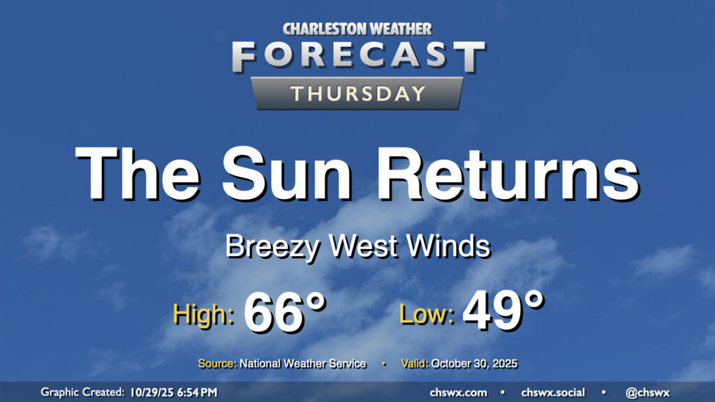
A cold front will swing through overnight, scouring out the clouds and ushering in drier high pressure behind it. It’ll be great to see the sun, which will make highs in the mid-60s feel quite nice. We’ll have a bit of a westerly breeze in the wake of the front, so keep that in mind if you have any plans to dine al fresco, but otherwise, it looks like a really good day of weather across the Lowcountry.
Friday & the weekend: Sunshine and seasonable temperatures continue
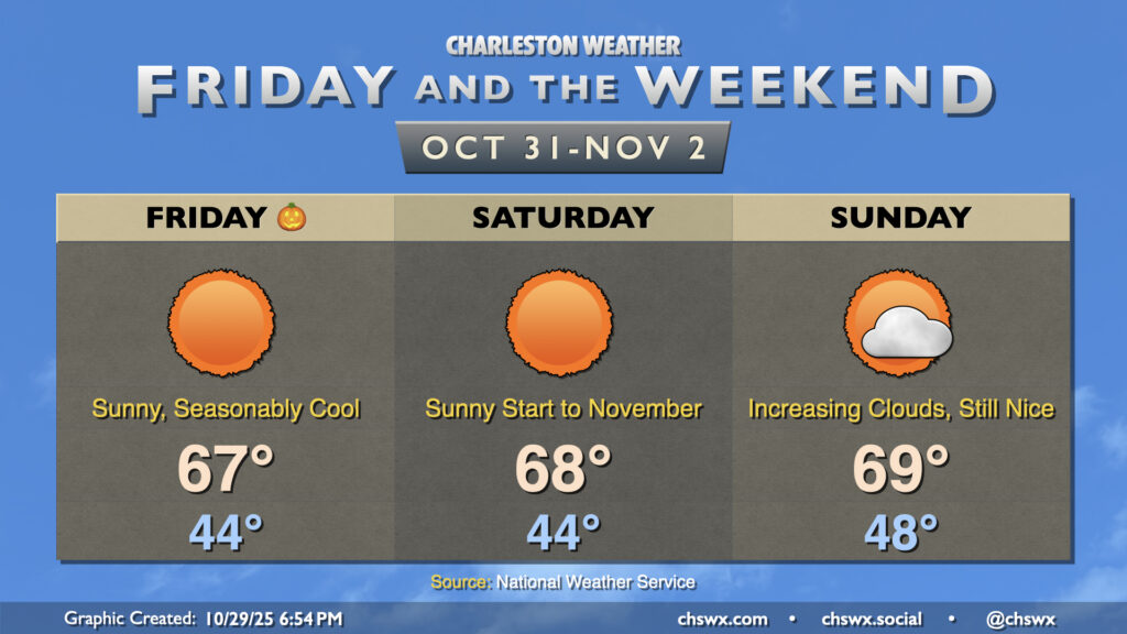
There’s nothing scary about the forecast for Halloween: Seasonably cool temperatures and plenty of sunshine will be the main weather story of the day as high pressure builds in. Lows in the mid-40s will warm to the mid-60s in the afternoon, still well below the normal high of 74° for October 31. You’ll probably want a light jacket for trick-or-treating as temperatures will fall into the 50s by 8PM.
We’ll start November in the same fashion we left October: lows in the mid-40s, perhaps cooling even lower further inland and in rural areas, warming to the upper 60s in the afternoon with plenty of sunshine. A bit more in the way of cloud cover begins to return on Sunday as another storm system develops in the Gulf, bringing another round of early-week rain chances to the area for Monday, but it’ll still be a nice day with highs in the upper 60s to around 70°.
Tropics: Melissa traverses Cuba and the Bahamas
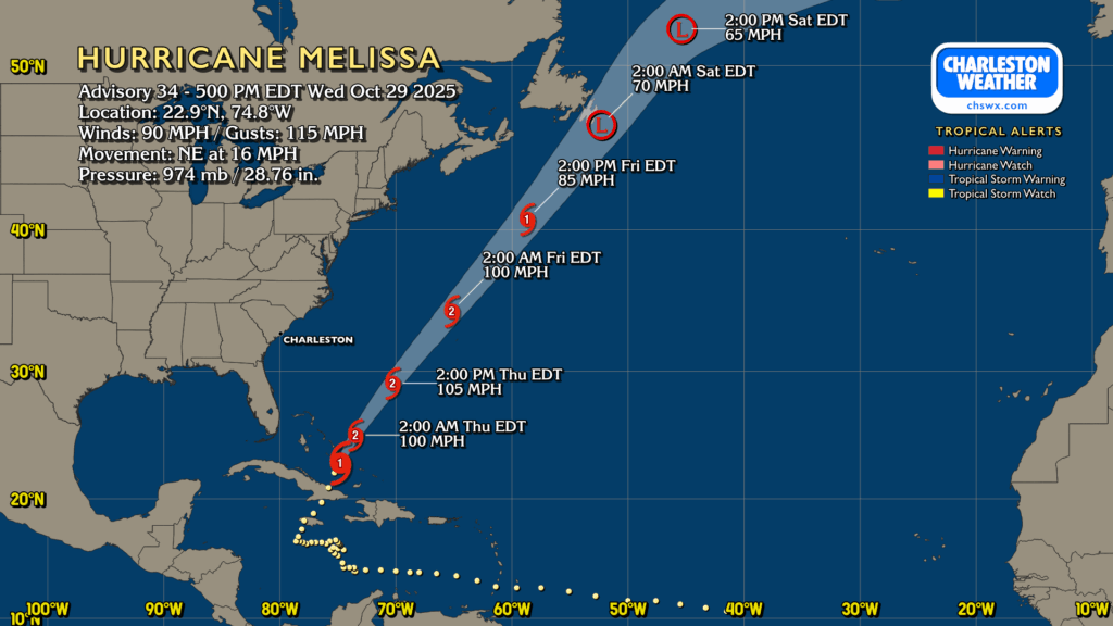
Hurricane Melissa made landfall on Cuba last night as anticipated, and the tough terrain disrupted the circulation enough to knock it down to a strong Category 1 storm as of the 5PM advisory. However, it’s back over water, getting some organization back, and will be affecting the Bahamas as a Category 2 storm through Thursday. It’ll be gaining forward speed as it moves northeastward toward Bermuda, which will probably take a glancing blow from what is expected to still be a Category 2 hurricane, though it’ll be short-lived as Melissa continues to accelerate northeastward toward extratropical transition over the weekend.
Follow my Charleston Weather updates on Mastodon, Bluesky, Instagram, Facebook, or directly in a feed reader. Do you like what you see here? Please consider supporting my independent, hype-averse weather journalism and become a supporter on Patreon for a broader look at all things #chswx!