Tuesday: Sunny and increasingly warm
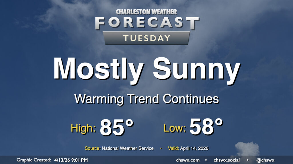
Stacked high pressure remains in control for Tuesday, yielding plenty of sunshine and a continuation of our warming trend. We’ll start Tuesday in the upper 50s to low 60s, warming to the mid-80s away from the coast. Expect downtown to peak in the upper 70s, while we may not get out of the upper 60s right at the beaches where the adjacent Atlantic waters continue to run in the upper 60s.
Rest of the work week: Warm and dry, with record heat possible by Friday

Warm and dry weather continues for the rest of the work week and into the weekend. Temperatures Wednesday and Thursday will continue to run in the mid-80s as a trough of low pressure passing to the north weakens the ridge slightly.
Things really heat up as we get into Friday. As high pressure at the surface retrogrades west and south and ridging rebuilds aloft, winds turn more westerly and northwesterly throughout the atmospheric column, promoting downslope flow which will bring some much warmer weather to the area as a result. The westerly winds also pin the seabreeze closer to the coast, bringing warmer air further eastward, making for a hotter day for places like the Sea Islands and downtown Charleston. Climate-wise, a record high is certainly probable at the airport. Friday’s high temperature of 91°, if verified, would tie the record high for April 17 set back in 1961. We’ll challenge Saturday’s record high as well, though Sunday should run a little cooler.

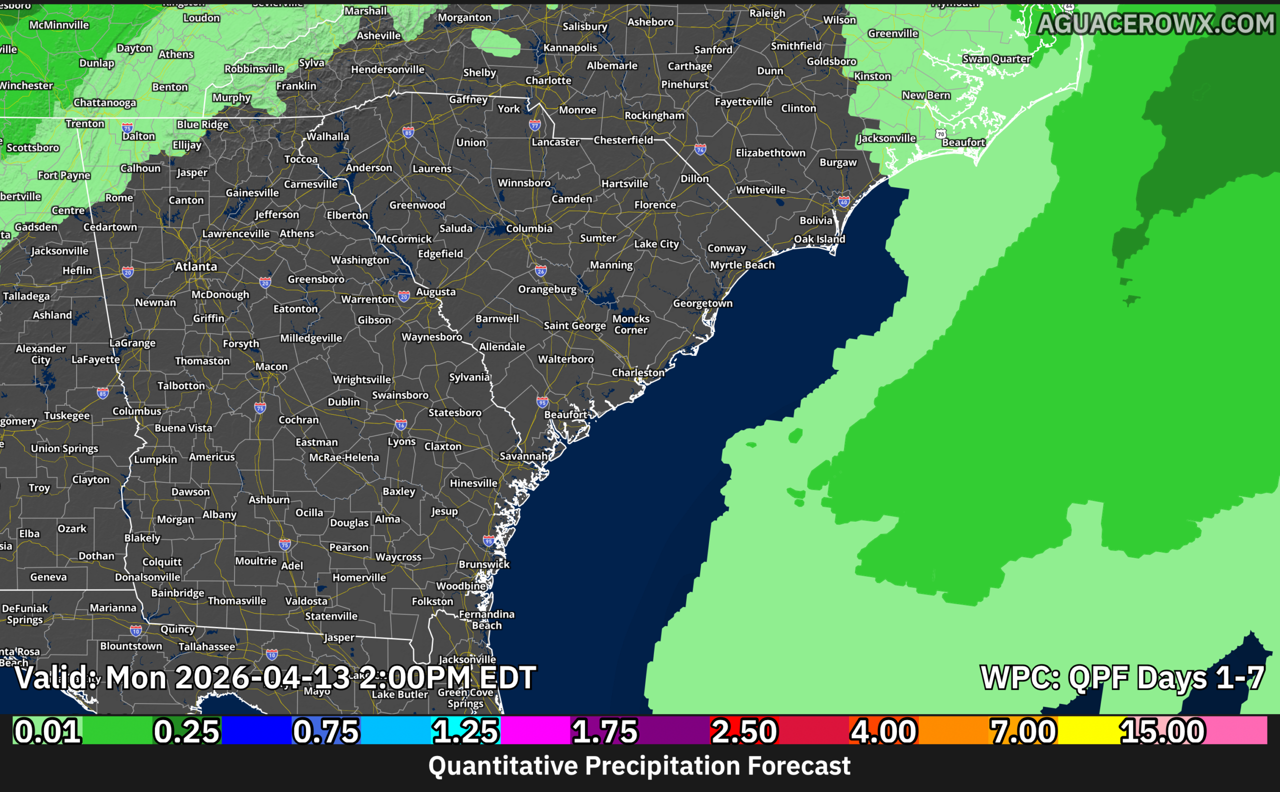
Unfortunately, the dry spell will only worsen the ongoing drought. The entire Tri-County area is in severe drought at this point, with extreme drought to our southwest. No measurable rainfall is expected over the next seven days, and this dry stretch may run even longer than that. As many dads on porches can attest, we could sure use the rain, and it just doesn’t look like there’s much to be had for much of mid-April at this point. We’ll keep you posted, but for now, keep those sprinkler schedules.
Follow my Charleston Weather updates on Mastodon, Bluesky, Instagram, Facebook, or directly in a feed reader. Do you like what you see here? Please consider supporting my independent, hype-averse weather journalism and become a supporter on Patreon for a broader look at all things #chswx!
Follow my Charleston Weather updates on Mastodon, Bluesky, Instagram, Facebook, or directly in a feed reader. Do you like what you see here? Please consider supporting my independent, hype-averse weather journalism and become a supporter on Patreon for a broader look at all things #chswx!