Rest of the work week: Warm weather continues with no rain in sight
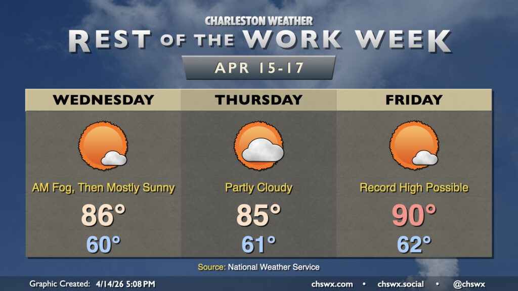
High pressure remains the main weather driver for the rest of the work week, keeping things generally quiet but also warm and dry — not great for the ongoing drought. Temperatures Wednesday will take another jump into the mid-80s across the area away from the locally cooler coastline with plenty of sunshine after some patches of morning fog. A disturbance aloft will cause an uptick in cloud cover for Thursday and keep temperatures close to Wednesday’s values, but it’ll still be plenty warm and well above normal for this point in the year.
The warmest period begins Friday and lasts until Saturday, in which high pressure anchored to our south drives more westerly wind trajectories at the surface and aloft. This will send temperatures to near record levels Friday, with highs in the low 90s a distinct possibility under mostly sunny skies.
Weekend outlook: Still warm, but changes afoot
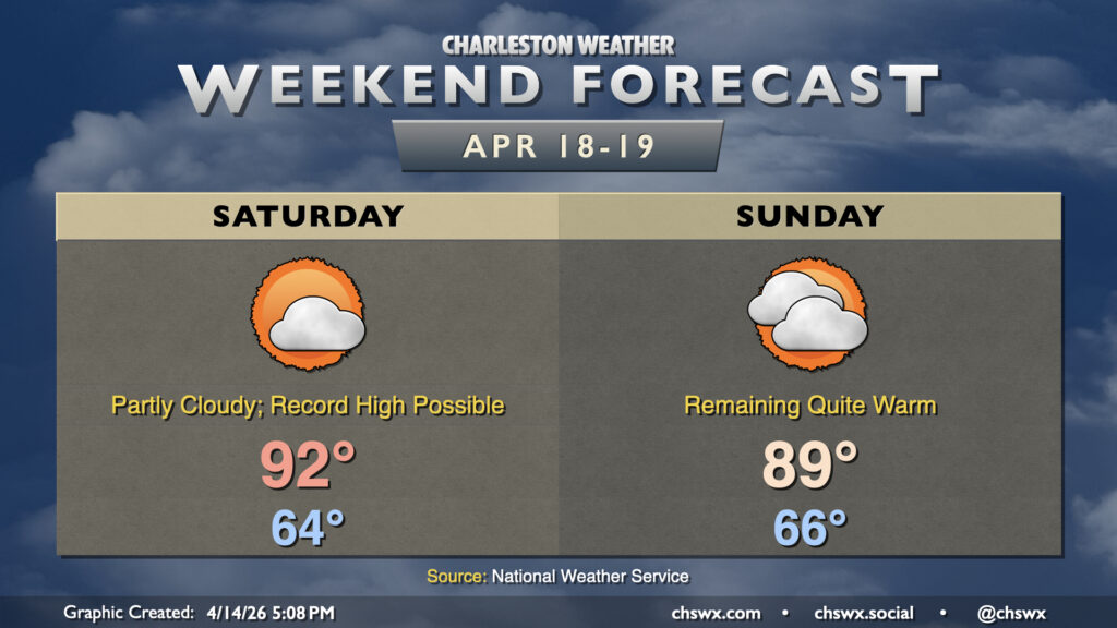
The weekend will remain on the warm side ahead of a cold front that will at least send temperatures closer to normal beginning next Monday. Until then, we can expect highs in the low 90s on Saturday — perhaps challenging record highs — and highs in the upper 80s on Sunday with a bit more in the way of cloud cover ahead of the front. Unfortunately, moisture is scarce and any appreciable rain remains very unlikely heading into next week, which will continue to worsen the drought across the Southeast.
Follow my Charleston Weather updates on Mastodon, Bluesky, Instagram, Facebook, or directly in a feed reader. Do you like what you see here? Please consider supporting my independent, hype-averse weather journalism and become a supporter on Patreon for a broader look at all things #chswx!