Thursday: Another warm day
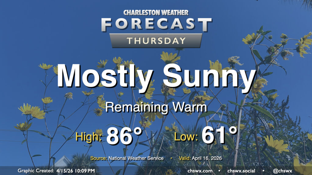
Well, we are running out of ways to tell y’all that it’s going to be warm and dry. High pressure remains the main weather driver across the area, keeping temperatures warmer than normal and rain chances virtually nil. We’ll start the day in the low 60s, warming to the mid-80s in the afternoon away from the coast, where onshore flow from the south will help keep temperatures pinned to the upper 60s. Expect downtown to peak a few degrees cooler, generally in the upper 70s to low 80s depending on your proximity to the water.
Friday & the weekend: Heat turns up another notch; stray storm Sunday?
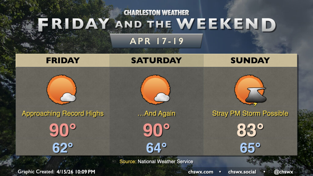
An impulse aloft will swing through North Carolina during the day Friday, which will help turn winds aloft more toward the west and northwest. This downslope flow and rebuilding ridging aloft will help temperatures take another leap, with a return to the 90s expected for Friday. This will challenge the daily record high for April 17 of 91° set in 1967. Temperatures at the coast will once again run much cooler, though the more westerly wind direction will help keep the seabreeze pinned a little longer, allowing the islands to get a little warmer.
Winds a few thousand feet up turn more southwesterly for Saturday as a cold front approaches, and with ridging continuing to nudge in from the south, we can expect another very warm — approaching record warm — day in the Lowcountry. We start the day in the mid-60s, warming to around 90° in the afternoon. This will be in striking distance of the daily high temperature record for April 18, which is 92° also set in 1967. Once again, mostly sunny skies are anticipated, with a dearth of moisture and sinking air aloft keeping a lid on any showers or thunderstorms.
Things change a bit starting Sunday with the aforementioned cold front coming through the area. It’ll be a cooler day, with highs only peaking in the low-to-mid-80s as cloud cover increases with the frontal passage. There’s even the potential for a few showers or storms, but moisture return ahead of the front just isn’t great, and anything that develops won’t be able to wring out much rain.
We turn cooler for a few days next week in the wake of the front, but dry weather rolls on with no rain in the forecast through Wednesday. The pattern shows signs of turning a little wetter as we close out April, but it’s going to take quite a bit of rain to eliminate the drought. A new Drought Monitor is released on Thursday, and we should expect severe drought to continue across the Tri-County.
Follow my Charleston Weather updates on Mastodon, Bluesky, Instagram, Facebook, or directly in a feed reader. Do you like what you see here? Please consider supporting my independent, hype-averse weather journalism and become a supporter on Patreon for a broader look at all things #chswx!