Thursday: Mostly sunny, but a bit smoky
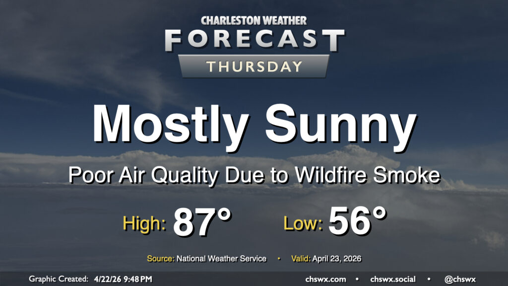
High pressure will remain in control on Thursday, keeping mostly sunny skies in place. It won’t be all sunshine, though, as smoke from nearby wildfires in Georgia drifts into the area, which could have negative impacts on air quality. An Air Quality Alert is in effect for the Lowcountry through Thursday evening as a result; people who have sensitivities to poor air quality should limit time outdoors. Temperatures will take another step up as southwesterly winds help pump in warmer air; expect lows in the mid-50s to warm to the mid-to-upper 80s in the afternoon.
Friday & the weekend: Some needed rain coming
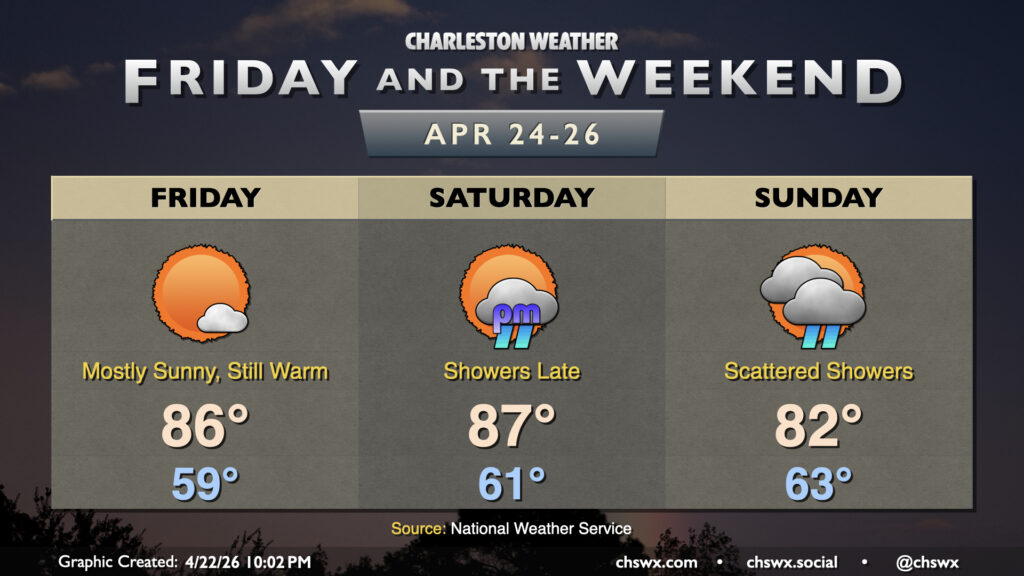
After one more dry and sunny day on Friday, we will start to see some changes as a cold front moves into the area later Saturday in the form of some much-needed rain. It won’t be a ton of rain — maybe a quarter-to-half-inch at best — but anything helps at least slow down the continued proliferation of severe to extreme drought across the Lowcountry. Temperatures Friday and Saturday will continue to run in the mid-to-upper 80s after starting in the upper 50s to low 60s. Behind the front, we’ll see some cooler air move in, but the potential for low pressure to develop nearby will keep shower chances in play for Sunday. The overall pattern turns a touch more unsettled in general for next week, with more rain chances possible as we head into the last week of April.
Follow my Charleston Weather updates on Mastodon, Bluesky, Instagram, Facebook, or directly in a feed reader. Do you like what you see here? Please consider supporting my independent, hype-averse weather journalism and become a supporter on Patreon for a broader look at all things #chswx!