Tuesday: Mostly cloudy and a bit on the cool side for mid-May
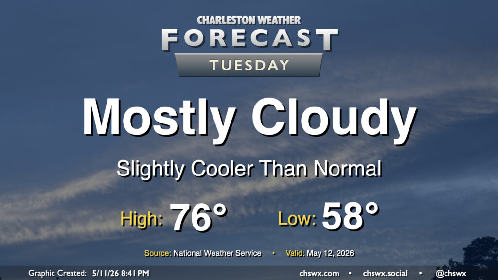
High pressure nudging in from the north will keep cloud cover in place and cool us off a bit for Tuesday after the third 90° day of the year on Monday. We’ll start the day in the upper 50s, warming to about the mid-70s given the expected cloud cover. A shower could get close to far southern Charleston County during the day, but most of us should stay rain-free.
Rest of the work week: A few showers Wednesday, then a couple nice days
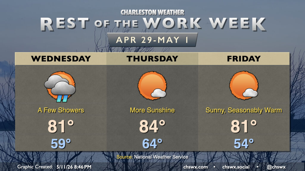
Another front approaches the area on Wednesday as low pressure spins up further to our south and east. Depending on the track of the low, a few showers could be flung toward the coast. The aforementioned front may also kick up a few showers overnight, but overall, model guidance is pretty dry across the area, so don’t get your hopes up too much for rain from this one. Temperatures Wednesday start near 60°, warming to the low 80s in the afternoon.
Clouds will scour out Thursday morning as the front clears the area, and a fairly nice day awaits as a result. Lows in the mid-60s warm to the mid-80s in the afternoon with plenty of sunshine and fairly dry air, with slightly warmer temperatures aided by northwesterly winds. Friday looks even better, with winds turning a little more northerly to help temperatures run a little cooler than they did on Thursday. Enjoy it, because temperatures will head to the mid-to-upper 80s Saturday and should reach 90° again on Sunday!
Follow my Charleston Weather updates on Mastodon, Bluesky, Instagram, Facebook, or directly in a feed reader. Do you like what you see here? Please consider supporting my independent, hype-averse weather journalism and become a supporter on Patreon for a broader look at all things #chswx!