Rest of the work week: Turning warmer and sunnier
Generally quiet weather will be the rule for the rest of the work week as dry high pressure builds in from the northwest, keeping temperatures near mid-May norms.
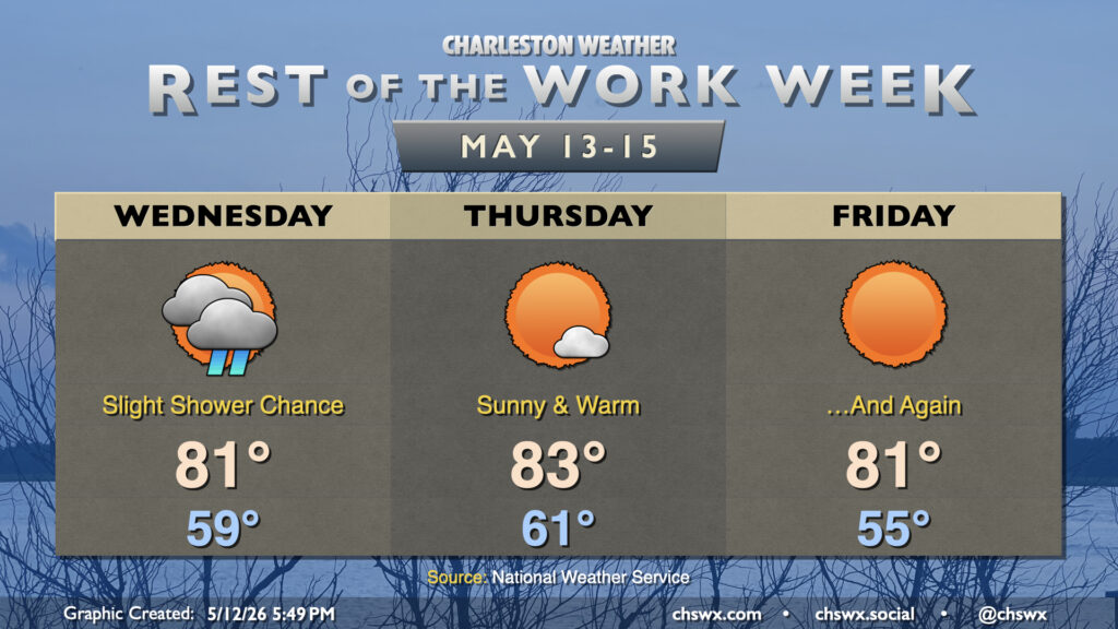
Clouds will be hanging around Wednesday as low pressure develops along a stalled front to our south. It’s highly unlikely that a shower will make it this far north, but it’s not totally out of the question. Otherwise, a cloudy but warmer day is expected as lows in the upper 50s warm to the low 80s in the afternoon.
A cold front swings through Thursday morning and high pressure will build back into the area with drier air to boot. Expect lows in the low 60s to warm to the low-to-mid-80s in the afternoon under mostly sunny skies. Winds go a little more northerly on Friday, which will cause temperatures to run a little cooler than they did on Thursday despite more sunshine — lows in the mid-50s yield to highs around 80-81° in the afternoon.
The near-normal temperatures don’t last, though. High pressure will shift offshore for the weekend, bringing about a warming trend that brings us back to the mid-80s on Saturday and the upper 80s to near 90° on Sunday.
Follow my Charleston Weather updates on Mastodon, Bluesky, Instagram, Facebook, or directly in a feed reader. Do you like what you see here? Please consider supporting my independent, hype-averse weather journalism and become a supporter on Patreon for a broader look at all things #chswx!