Thursday: More sunshine, comfortable warmth
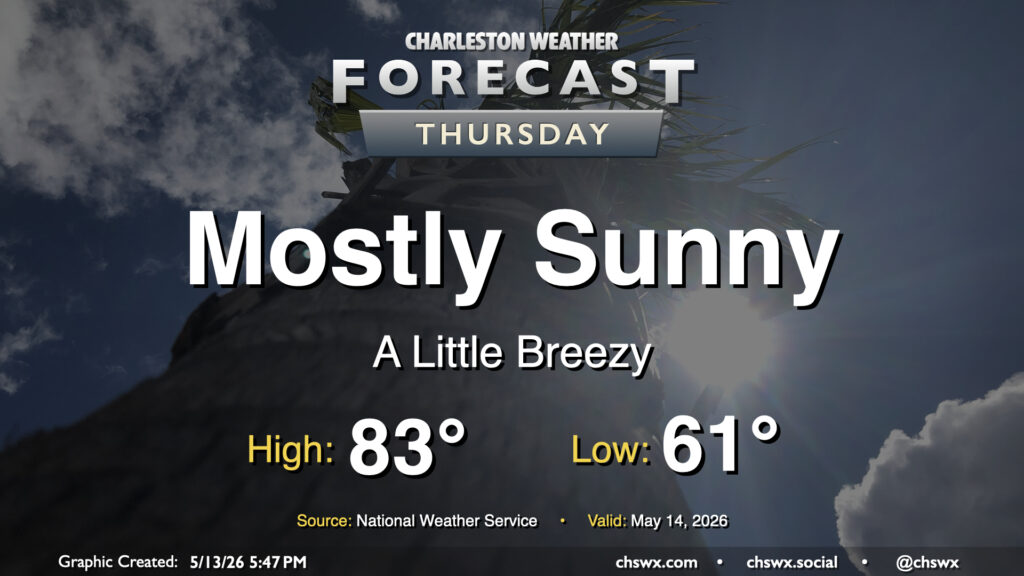
A cold front will swing through early Thursday with high pressure to build in behind it. Temperatures will start in the low 60s, warming to the low-to-mid-80s in the afternoon with northwesterly winds around 10 MPH. The downslope flow will dry out the atmosphere pretty nicely, allowing for mostly sunny skies with maybe a few fair weather clouds. The drier air will make the 80s highs feel a little more comfortable, too. Overall, it’s a good day to try to get some sunshine in the midst of the daily grind.
Friday & the weekend: Sunshine to continue with temperatures turning a touch warmer
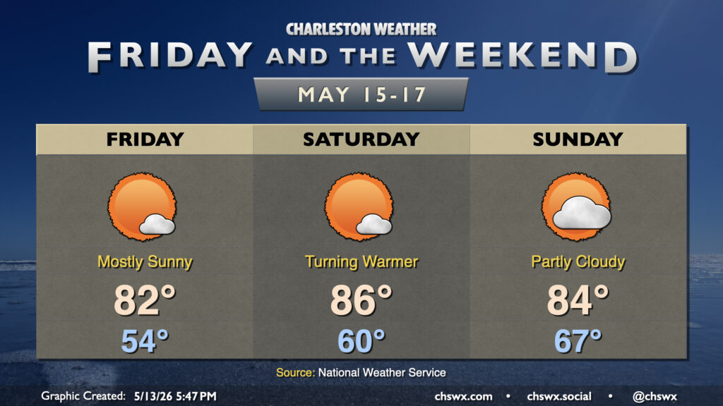
The really nice weather continues into Friday, with a fairly cool start in the mid-50s warming to the low 80s in the afternoon with primarily sunny skies persisting. High pressure will slip offshore for the weekend, bringing dewpoints back to the 60s and contributing to a little more in the way of cloud cover. However, rain should not be an issue (though the lack of rain is arguably the issue), and temperatures will continue to run in the mid-80s away from the locally cooler coastline. Warm and dry weather will continue heading into early next week, with the next (slight) rain chance perhaps arriving Tuesday.
Follow my Charleston Weather updates on Mastodon, Bluesky, Instagram, Facebook, or directly in a feed reader. Do you like what you see here? Please consider supporting my independent, hype-averse weather journalism and become a supporter on Patreon for a broader look at all things #chswx!