Tuesday: Plenty of sunshine — and plenty warm, too
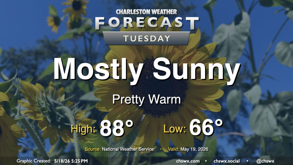
More sunshine is in the offing for Tuesday with high pressure in continued control of our weather. The air will have a bit of an early summer feel to it with lows bottoming out in the mid-60s, warming to the upper 80s and perhaps approaching 90° in the afternoon. Dewpoints will mix down to the mid-60s in the afternoon, so while it won’t be excruciatingly humid, there will definitely be a bit more heaviness to the air, so to speak.
Rest of the work week: 90s return, with scattered storms to follow
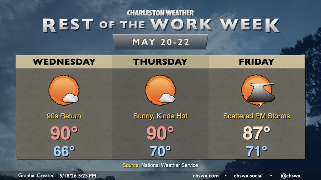
The rest of the work week will remain well on the warm side of normal, with high temperatures approaching 90° Wednesday and Thursday under partly cloudy to mostly sunny skies. Dewpoints will be ticking up, and it will continue to feel a little more humid, though not to a point where heat indices become something to really sweat just yet. Still, it’s a harbinger of things to come as we approach June.
High pressure will lose its influence over the area by Friday allowing a backdoor front to approach from the north, and that will contribute to better shower and thunderstorm chances in the afternoon and evening as a result. Not everyone will see rain, though, and that front is not going to make it here, either, as we stay warm and occasionally unsettled heading into the weekend.
Coastal flooding concerns Monday night
Heads up if you are headed downtown: A Coastal Flood Advisory is in effect between 9pm and midnight for another round of possible minor tidal flooding with the 10:19 PM high tide. There is a risk for coastal flooding again Tuesday night, but overall, water levels will diminish as we get further away from the new moon and perigee.
Follow my Charleston Weather updates on Mastodon, Bluesky, Instagram, Facebook, or directly in a feed reader. Do you like what you see here? Please consider supporting my independent, hype-averse weather journalism and become a supporter on Patreon for a broader look at all things #chswx!