Rest of the work week: 90s return
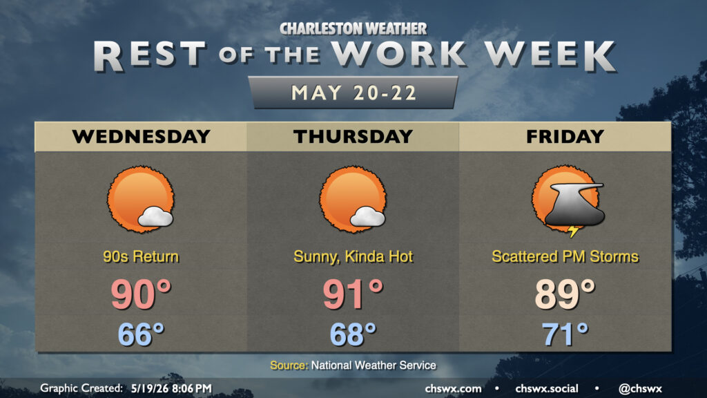
High pressure at the surface and aloft along with plenty of sunshine will help bring the 90s back to the Lowcountry over the next few days for the first time since mid-April. Dewpoints will not quite head back to those summertime 70s just yet, thankfully, so heat indices will remain in check, but it’ll still be plenty warm and a harbinger of things to come as we head toward June.
As we head toward Friday, we’ll start to see the influence of the stacked high break down a little, allowing for a little more in the way of afternoon thunderstorm activity. Temperatures will remain warm — running in the upper 80s to around 90° on Friday — with dewpoints a couple clicks warmer as well, making for a little more humid feel to the air. We’ll see this pattern hang tight for a few days, too. As we get toward summer, this isn’t anything out of the ordinary. Don’t cancel outdoor plans, but make sure you’ve got a good secondary indoor plan as well. Unfortunately, while any rain helps, don’t expect to see much of a dent in the drought. A few spots may see heavy downpours, but overall, extreme to exceptional drought looks to continue across the area.
Follow my Charleston Weather updates on Mastodon, Bluesky, Instagram, Facebook, or directly in a feed reader. Do you like what you see here? Please consider supporting my independent, hype-averse weather journalism and become a supporter on Patreon for a broader look at all things #chswx!