Thursday: One more warm and sunny day before unsettled conditions return
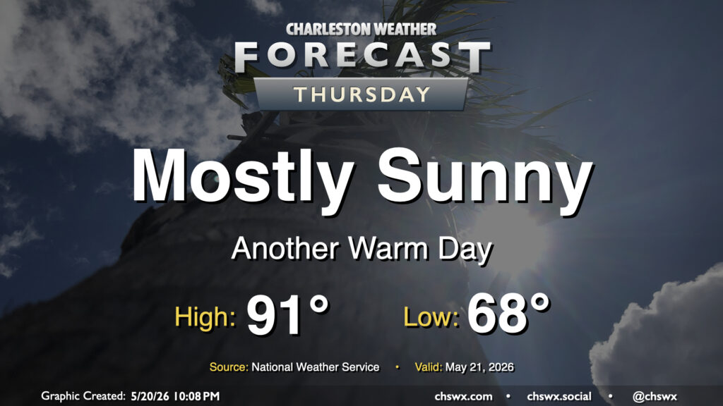
After another day in the upper 80s on Wednesday — just missing 90° by a couple degrees at the airport — we should turn even a little warmer for Thursday with plenty of sunshine to be had. It’ll be a bit of a balmy day in general as lows in the upper 60s warm to the low 90s in the afternoon. Mid-60s dewpoints will keep the heat index in check, though it may feel a tick or two warmer than the air temperature.
Friday & the weekend: Unsettled weather returns, but no washout
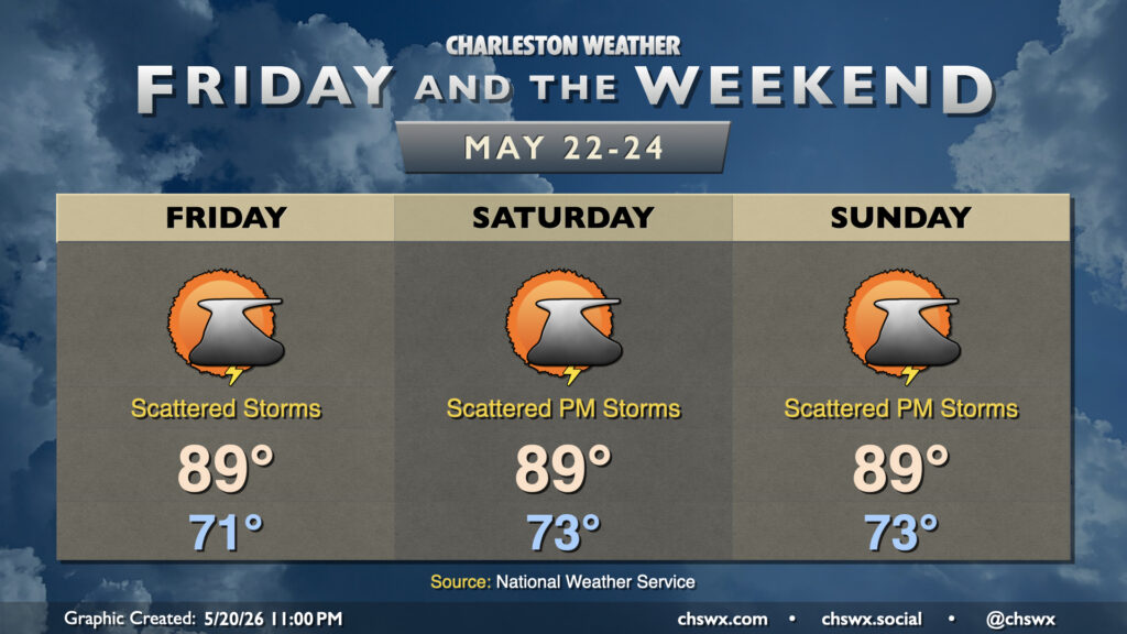
A front will sag southward and stall out north of the area on Friday, helping to instigate some showers and thunderstorms throughout the day. Right now the best chances appear to be earlier in the day based on the timing of the front’s closest approach. We’ll stay in the warm air, though, with lows in the low 70s warming to near 90° in the afternoon.
The front retreats back northward Saturday, and we stay in a warm and humid airmass that certainly will have all the feeling of early summer for the next few days — generally fitting for the Memorial Day weekend. Temperatures each day will start out in the low to mid-70s, warming to near 90° in the afternoons. Scattered showers and thunderstorms will be possible each afternoon, generally inland of the coast. Some of you may get some much-needed rain, but others may be completely shut out — just no solid relief from this drought is in sight. This pattern will continue into Memorial Day and through at least the middle of next week.
Follow my Charleston Weather updates on Mastodon, Bluesky, Instagram, Facebook, or directly in a feed reader. Do you like what you see here? Please consider supporting my independent, hype-averse weather journalism and become a supporter on Patreon for a broader look at all things #chswx!