Friday & Memorial Day Weekend: Periodically unsettled, but no washout
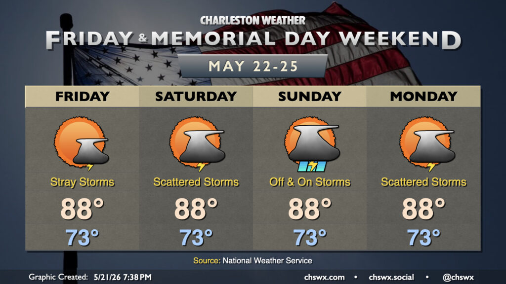
It’s a very summer-like look to the forecast this Memorial Day Weekend as the Lowcountry sits on the fringes of Atlantic high pressure. The pattern is largely stagnant as evidenced by the copy & paste temperatures for the next few days: lows in the low to mid-70s, highs in the upper 80s to near 90°.
There will be shower and thunderstorm chances in there, too, but this weekend doesn’t look like a washout by any stretch. It certainly doesn’t look like it will be much of a drought reliever, either, with forecast rainfall totals generally in the half-inch range through the middle of next week. The better rainfall amounts will be found further inland; in fact, it’s not out of the question that some folks closer to the coast may not see diddly squat (technical term) with much of the shower and storm activity driven by the inland-moving seabreeze.
As storm chances go, Friday will be fairly sparse, and much of us should get the day in rain-free. Isolated to scattered storms are possible on the seabreeze Saturday, while Sunday will feature a slightly better chance for showers and storms as a disturbance moves by. More standard afternoon thunderstorm chances return for Memorial Day, with any storms generally expected to stay inland of the beaches. This periodically unsettled pattern looks to continue well into next week, too, which may at least help some of us not have to fire up the sprinklers on a daily basis, at least.
Follow my Charleston Weather updates on Mastodon, Bluesky, Instagram, Facebook, or directly in a feed reader. Do you like what you see here? Please consider supporting my independent, hype-averse weather journalism and become a supporter on Patreon for a broader look at all things #chswx!