Tuesday: A scattering of storms ahead of another front
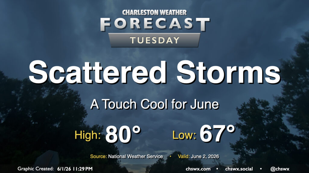
We should see another scattering of showers and thunderstorms on Tuesday in association with a cold front that will make for a rather nice second half of the work week. Temperatures will start in the mid-to-upper 60s, warming to just about 80° in the afternoon as the front pushes further southward and drier air begins to find its way in. Dewpoints should fall nicely late Tuesday into Wednesday, setting up a stretch of spring-like conditions through Friday.
Rest of the work week: Warming up, but still comfortable
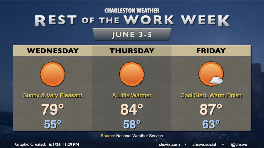
Dry high pressure builds in from the northeast on Wednesday, and it’ll make for a nice few days to wrap up the first work week of June. Temperatures Wednesday start in the mid-50s — a typical low on June 3rd is 68° — warming to the upper 70s to around 80° in the afternoon with nearly unfettered sunshine and low humidity. The airmass will begin to moderate on Thursday, with lows in the upper 50s warming to the mid-80s in the afternoon, with clear, sunny skies once again as high pressure continues to ridge in at the surface and aloft. The surface high starts to get offshore on Friday, and winds turn a little more south and east as a result. These trajectories will bring in warmer and slightly more humid air to the area. Lows in the low-to-mid-60s (still below normal) will warm to the mid-to-upper 80s in the afternoon with perhaps a few more clouds than the previous couple days as dewpoints start to tick back up a bit. We’ll stay warm but rain-free through the weekend, it looks like, before shower chances return Monday.
Follow my Charleston Weather updates on Mastodon, Bluesky, Instagram, Facebook, or directly in a feed reader. Do you like what you see here? Please consider supporting my independent, hype-averse weather journalism and become a supporter on Patreon for a broader look at all things #chswx!