Tuesday: Heat advisory, then afternoon storms
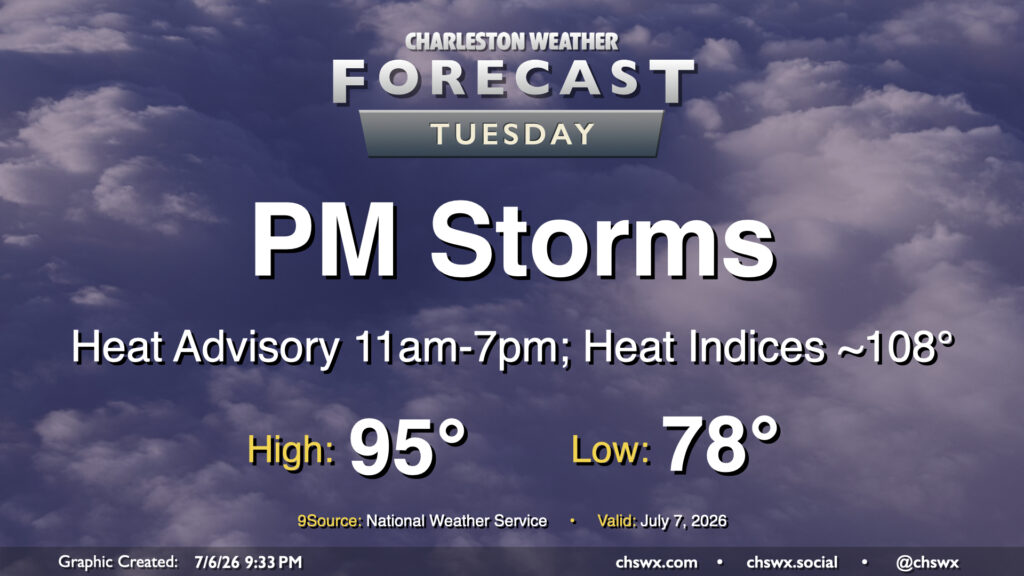
The heat wave continues Tuesday with another hot and humid day on tap, followed by a scattering of afternoon thunderstorms. We’ll start in the upper 70s inland to low 80s near the coast and downtown, warming to the mid-90s in the afternoon. Dewpoints in the mid-70s will drive heat indices toward 108-110°. Another Heat Advisory will be in effect for Charleston and Berkeley counties as a result. Further inland toward Dorchester, dewpoints should be ever so slightly low enough to stay out of Heat Advisory criteria, but it’s still going to be plenty hot.
From there, a few thunderstorms should fire along and ahead of the seabreeze. Storm motions should be a little more coastward, so keep an eye out at the beaches for possible thunderstorms. A stray severe storm is not out of the question, with damaging wind gusts and hail to the size of quarters possible.
Rest of the work week: Air temperatures turn up another notch
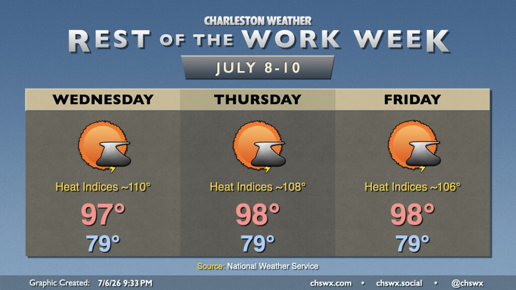
As we get toward Hump Day and the second half of the work week, we will see air temperatures turn up a click or two as winds go more westerly. Highs Wednesday top out in the mid-to-upper 90s, while we’ll solidly head to the upper 90s for Thursday and Friday. Heat indices will continue to run well into the 100s, with Heat Advisory criteria a possibility particularly Wednesday and Thursday. An isolated shower or thunderstorm will be possible each afternoon, but rain chances will generally run lower than the start of the week with a bit more dry air in place.
Follow my Charleston Weather updates on Mastodon, Bluesky, Instagram, Facebook, or directly in a feed reader. Do you like what you see here? Please consider supporting my independent, hype-averse weather journalism and become a supporter on Patreon for a broader look at all things #chswx!