Thursday: Another hot day before turning unsettled this weekend
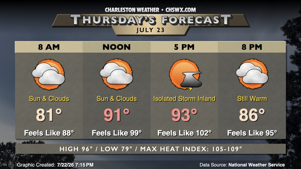
Heat peaks on Thursday before a cold front affects the area this weekend, bringing more widespread unsettled weather to the area starting Friday.
Thursday will begin in the upper 70s to low 80s once more, with a mix of sun and clouds expected. Like the past few days, we may see a few coastal showers during the morning hours in the Highway 17 corridor and points east, while a stray thunderstorm will be possible along and inland of 17-A in the afternoon as the seabreeze progresses inland. However, many of us should stay rain-free as temperatures soar into the mid-to-upper 90s in the afternoon. Heat indices will peak around 105° inland and closer to 109° near the coast. It’s not out of the question that we may see a Heat Advisory for at least parts of the area, so stay tuned.
Friday & the weekend: Front stalls out nearby, keeping showers and storms around
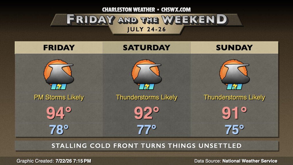
We’ll see a front steadily approach the area Thursday night into Friday, stalling out across the Midlands and helping to turn our weather unsettled as waves of low pressure ripple across the area. Friday morning should start on the quiet side, but thunderstorms become more likely as the heat of the day kicks in during the afternoon. Off and on shower and thunderstorm chances will then continue heading through the weekend as the front wobbles across the Carolinas. Heavy downpours moving across the area will increase the risk for flooding in urban areas, with the greatest risk coming Saturday. On & off showers and storms continue on Sunday as well. Temperatures will at least get closer to normal for mid-to-late July, generally peaking in the low 90s.
Follow my Charleston Weather updates on Mastodon, Bluesky, Instagram, Facebook, or directly in a feed reader. Do you like what you see here? Please consider supporting my independent, hype-averse weather journalism and become a supporter on Patreon for a broader look at all things #chswx!