Thursday: Still warm, but not quite as humid
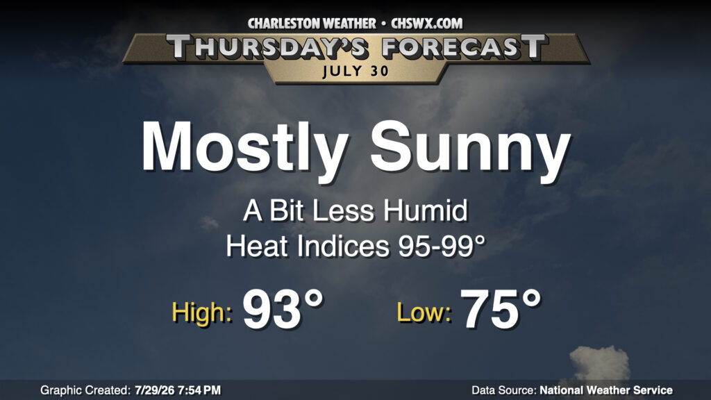
What looks to be a top-five-warmest July on record will close on a slightly cooler and drier note as high pressure nudges in from the north. Thursday starts in the mid-70s across the area, warming to the low-to-mid-90s in the afternoon with plenty of sunshine. As mentioned, the drier air will keep heat indices a little more in check, though they may still get close to 100° near the coast where the more humid maritime airmass resides. But with all that in mind, it’ll still feel better outside than it did at the start of the week.
Friday & the weekend: One more less humid day, then turning unsettled to start August
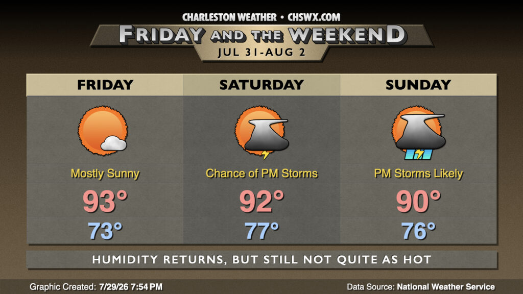
Friday will be another mostly sunny and not-oppressively-humid day, with lows in the low 70s warming to the low-to-mid-90s in the afternoon. No concerns to close out the work week.
August will begin with an uptick in humidity as return flow ahead of a low pressure system moving across the Ohio Valley pumps higher-dewpoint air back into the area. For the first time in a couple days, we can expect a few afternoon thunderstorms to develop as the stalled front nearby lifts back across the area as a warm front. Lows will be noticeably warmer — back to the upper 70s inland, perhaps pushing 80° at the coast and downtown — but highs will peak in the low 90s given an uptick in cloud cover and the expected thunderstorms. Not everyone gets rain, though, so don’t cancel anything just yet.
Storms turn a little more likely on Sunday as deeper moisture finds its way in. Precipitable water values — think of it as how much water you can wring out of a column of air — soar past 2″, which is a good indicator for heavy rainfall. We’ll see an uptick in showers and thunderstorms as we head into Sunday afternoon and evening as a surface low moves across the Ohio Valley, lifting a warm front into the Midlands before it stalls back out and falls apart on Monday. Heavy rain and lightning appear to be the main concerns with weak shear, though an isolated wet downburst may not be out of the question given the water-loaded atmosphere.
Follow my Charleston Weather updates on Mastodon, Bluesky, Instagram, Facebook, or directly in a feed reader. Do you like what you see here? Please consider supporting my independent, hype-averse weather journalism and become a supporter on Patreon for a broader look at all things #chswx!