The week ahead: High heat returns; heat advisories possible
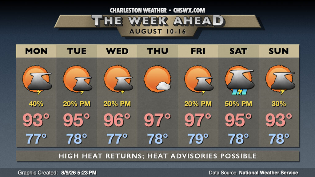
The main weather story this week will be the return of heat that will be reminiscent of what we experienced earlier in July, with another round of dangerous heat indices pushing 110-115° at times.
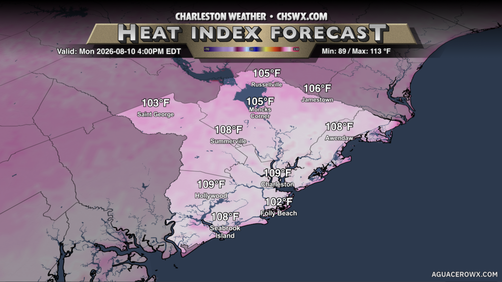
The heat will begin to turn up on Monday with deep westerly flow establishing itself across the area. There will be the potential for heat indices along and east of 17-A to approach 110° by mid-afternoon, while further inland heat indices will run closer to 105° as dewpoints run a couple clicks lower. We’ll have the best shot at getting some relief from the heat courtesy of afternoon thunderstorms on Monday, though, as the seabreeze pushes inland and storms instigate. As is typical during the summer, we can expect brief heavy downpours with any thunderstorms that fire, along with frequent lightning and maybe even some strong winds.
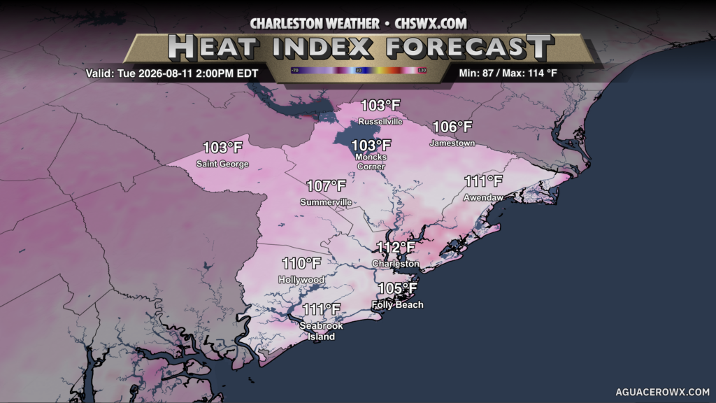
We’ll start to see high pressure begin to ridge in aloft on Tuesday, and this will help begin to turn up the air temperature across the metro. With dewpoints continuing to run in the mid-to-upper 70s, we can expect heat indices to make another run at 110° in the afternoon. It appears more likely that we’ll see some Heat Advisories on Tuesday, especially given that we should see lower coverage of afternoon showers and thunderstorms with the ridge aloft increasingly becoming more stout.
Air temperatures will continue to run in the mid-to-upper 90s through the end of the week, with heat indices continuing to run well into the 100s and perhaps approaching 110° closer to the coast. Additional heat advisories appear likely, with minimal shower and thunderstorm chances through Friday. We could see a disturbance ripple through Saturday afternoon and evening, which might kick up rain chances a bit. However, hot weather looks to continue into the weekend.
Tropics: A few spots of interest, but no immediate concerns
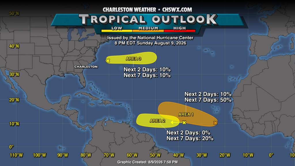
The tropics have been very, very quiet given the ongoing strong El Niño, but as we get into the climatologically-favored time of year for tropical development, the National Hurricane Center is monitoring three areas for development. Two of these areas have relatively low probabilities to develop, but the area south of the Cabo Verde islands has a 50% chance to develop into a tropical cyclone over the next few days. It’s not clear that whatever develops has a good chance to survive long, though. So, right now, there’s nothing for us to be really concerned about — just a good reminder that we are headed into the peak of hurricane season.
Follow my Charleston Weather updates on Mastodon, Bluesky, Instagram, Facebook, or directly in a feed reader. Do you like what you see here? Please consider supporting my independent, hype-averse weather journalism and become a supporter on Patreon for a broader look at all things #chswx!