Tuesday: Heat starts to turn up
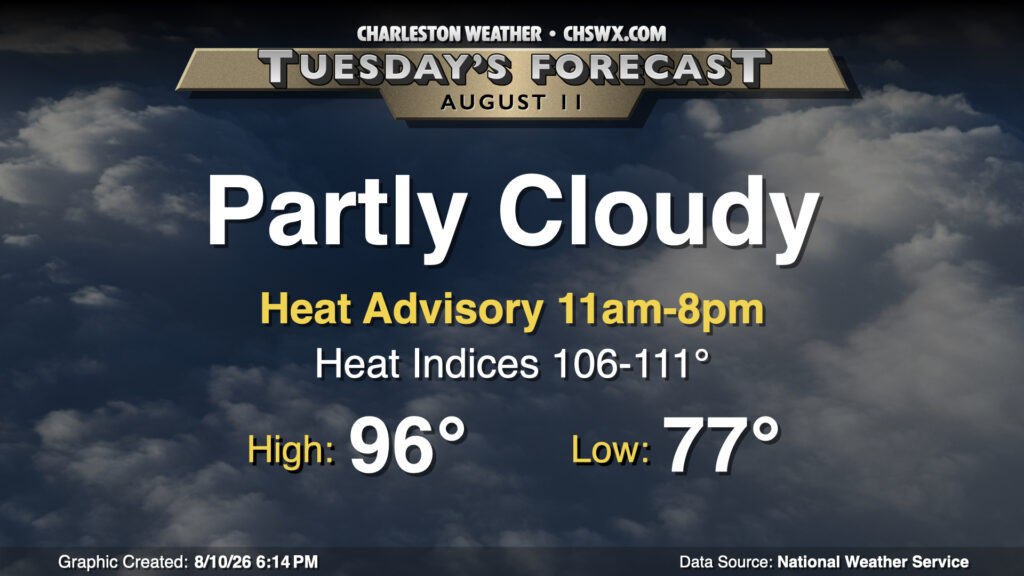
It’s a very toasty start to the school year for Charleston County on Tuesday as this week’s heat wave will begin in earnest as high pressure aloft takes hold. We’ll start the day on a very mild note, with lows in the mid-to-upper 70s warming to the mid-90s in the afternoon. Dewpoints will run in the low-to-mid-70s inland, while closer to the coast, they’ll run in the upper 70s. That will help drive heat indices solidly into the 100s, with the highest heat indices expected in the Highway 17 corridor and points east. A Heat Advisory will be in effect for Charleston County and the southern part of Berkeley County from 11am-8pm, when heat indices should exceed 108° and could top out near 111° as the seabreeze pushes by. The aforementioned high pressure will make it much harder for thunderstorms to develop, though a couple popup showers will be possible. With that in mind, though, don’t count on thunderstorms to impart any relief from the heat.
Rest of the work week: Turning dangerously hot, especially near the coast
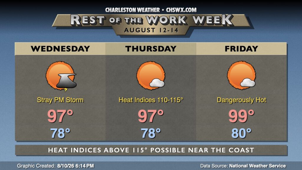
The heat will continue to build during the second half of the work week, with upper 90s air temperatures combining with mid-to-upper 70s dewpoints (perhaps even around 80° downtown) for heat indices well over 110° across much of the area, with heat indices potentially approaching 115°+ in the Highway 17 corridor when the seabreeze starts pushing inland during the afternoon. Heat Advisories are a certainty at a minimum, with Extreme Heat Watches and maybe Warnings looking increasingly likely as we get toward the end of the week. In fact, we may flirt with 100° air temperatures on Friday — something to watch closely. Since 1937, the airport has reached 100°+ in August nine times — including the all-time record high on August 1, 1999 when it hit 105°. It wouldn’t be out of the question to see a tenth occurrence this week — stay tuned.
Looking for thunderstorms to cool things off? Don’t expect much in the way of storms breaking through with strong high pressure aloft. We could see a stray storm or two — it’s hard to keep the atmosphere totally down this time of year — but once again, don’t really count on storms to cool you off.
Tropics: Chances tick up for far-off disturbance
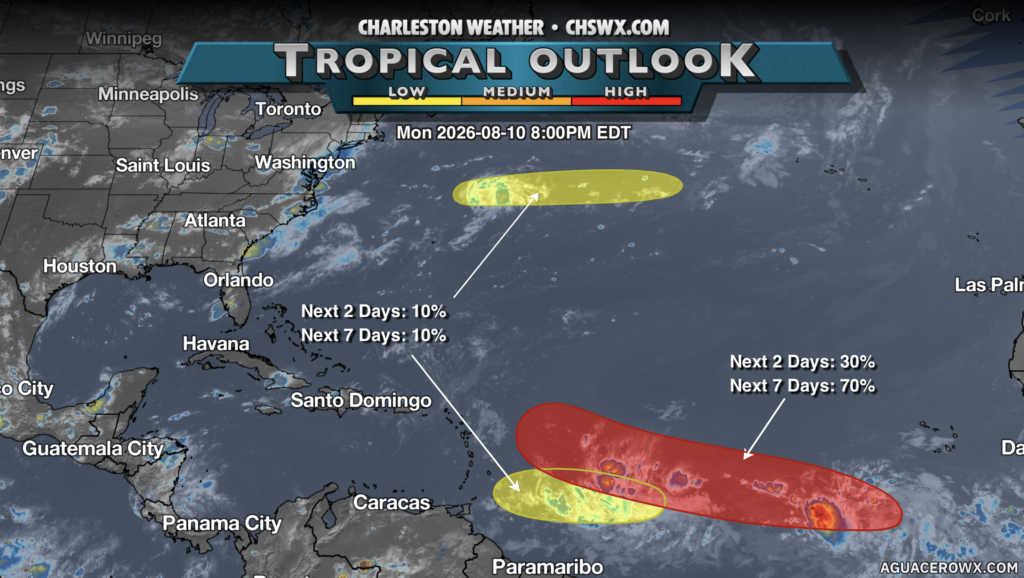
Finally, we continue to see three areas of interest in the tropics, but really only one area worth writing home — a wave to the southwest of the Cabo Verde Islands. Development chances on this storm have entered the high category, with a 70% chance for a tropical cyclone to form over the next seven days. We’ll continue to monitor, but right now there’s nothing to really be overly concerned about here.
Follow my Charleston Weather updates on Mastodon, Bluesky, Instagram, Facebook, or directly in a feed reader. Do you like what you see here? Please consider supporting my independent, hype-averse weather journalism and become a supporter on Patreon for a broader look at all things #chswx!