Rest of the work week: An ever-so-brief encounter with drier air
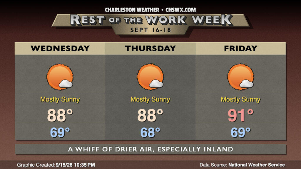
Drier air courtesy of high pressure wedging southwestward across the area will characterize the rest of the work week, bringing slightly more comfortable dewpoints to the area and seasonable temperatures for mid-September.
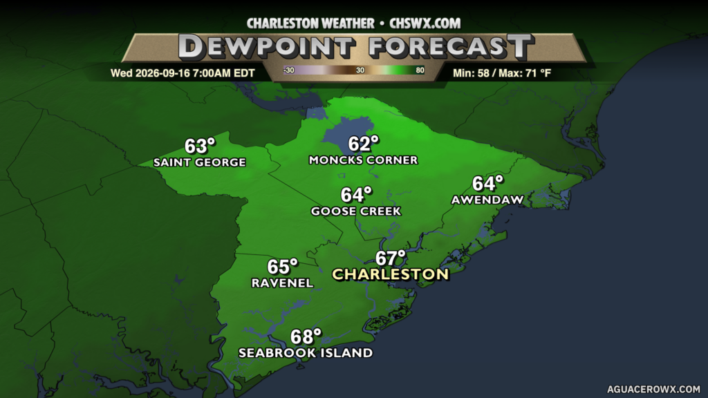
Drier air will steadily push into the area overnight, and by morning, it should feel a little better outside, especially the further inland you go. At the coast, dewpoints will run in the upper 60s to around 70° to start the day, but as you head toward the 17-A corridor, you begin to encounter dewpoints in the low-to-mid-60s. This combined with temperatures in the upper 60s should make for a comfortable start to Wednesday. We’ll warm to the upper 80s in the afternoon with just a few clouds as plenty of dry air in the column and sinking air both at the surface and aloft puts a lid on much in the way of cloud development. We will see the seabreeze come in later in the day, and that will send dewpoints back to around 70° in the metro during the afternoon, bringing a little more humidity back into the picture.
Thursday looks similar with high pressure remaining in control at the surface and aloft. We start to see some signs of changes Friday, though, as surface high pressure gives way to another cold front that begins to approach the area. This brings some higher dewpoints back into play, and highs head back into the low 90s in the afternoon as the front approaches.
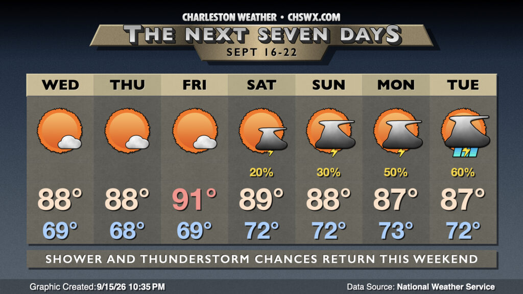
By Saturday, slight shower and thunderstorm chances return to the forecast along with a return to warm and muggy mornings with highs in the upper 80s to around 90° in the afternoons. That front never gets through, though, lifting back to the north as a warm front on Sunday. The work week looks to get off to a bit more of an unsettled start, though, as a trough of low pressure sets up along the coast, keeping a focus for a bit more in the way of shower and thunderstorm coverage in play.
Follow my Charleston Weather updates on Mastodon, Bluesky, Instagram, Facebook, or directly in a feed reader. Do you like what you see here? Please consider supporting my independent, hype-averse weather journalism and become a supporter on Patreon for a broader look at all things #chswx!